Manchester to Princeton (coming home and final thoughts)

I’m still on my early morning routine! Woke up at 4:30 am to do the Day 14 blog and then got the rest of the crew up at 6 so we could catch the train to the airport.

IMAGE.JPG

While our train was delayed, we were able to catch another one that got us there with plenty of time to spare. Flight home went smoothly and got us in an hour early- we all just watched movies and had good vegan breakfasts during our flight.

IMG_4219.jpeg

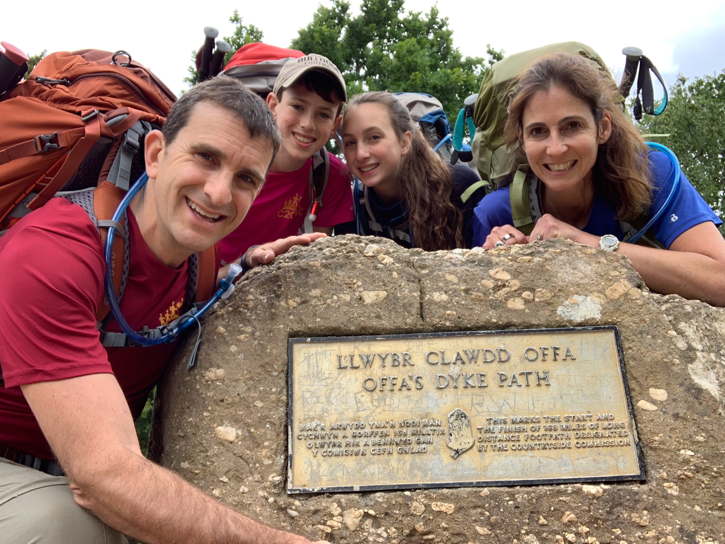
Our uber dropped us off at our house at 12:20 PM. We took a final picture and bid adieu to C2C4C 2019!

IMG_4234.jpeg

And now for some final thoughts!

This trek presented completely new challenges for us just when we thought we had the C2C4C game plan running smoothly. We obviously hadn’t planned for Olivia being so drained and then getting a stomach virus. I’m sure this was an even bigger disappointment for Olivia than it was for us. But we all had to deal with going with the flow and learn (or relearn) a life lesson: planning is important for anything one does, but it is even more important to be able to adapt to the changes that are bound to happen. I’m proud of how our family handled the situation.

We also didn’t plan for the amount of rain we encountered the first week, but we were prepared for it as far as our clothing was concerned. And it reinforced another life lesson: No matter how dark and gloomy things look (metaphorically or actually), the sun will return and will be appreciated even more after its abs ends. Those dark days really reinforce appreciation and gratitude.

The trip also reinforced how important it is (at least for Lara and me) to spend time in nature. We often take an hour here or there when possible. However, every once in a while it is important for us to take an extended period of time (at least a week or two) to get away from daily routines and stresses.

If our adventure gives you inspiration to do your own trip alone, with friends, or with your family, we hope you will follow that urge. And especially if you have children age 10+, we think this is a great opportunity for family bonding and teaching some important life lessons. Lara and I agree as far as ranking our three treks: 1) England’s Wainswright Trail 2) Wales’ Offa’s Dyke Path (only slightly behind) 3) Scotland’s John Muir Way (there are other hikes we would recommend over this one in Scotland.)

And if you are going to do a multi-day hike here are a few suggestions:

  1. Good hiking sneakers and socks are essential. Happy feet = happy hiker. We all had different shoes because what fit well for one of us didn’t work for the other. That being said, we all chose Gore-Tex sneakers instead of hiking boots. While our feet still got wet on really bad days, all of our shoes worked well and were a lot lighter than hiking boots.

  2. If you can afford a Garmin watch, get one! We found that it helped keep us on course a lot more than just using a map. However, don’t just rely on electronic GPS. As I learned, sometimes it can be faulty. It took me until the end of the trip to figure out that the reason my watch sometimes didn’t work was that I was starting it while off the course (at our lodging, instead of when we met back up with the ODP.) Knowing how to read maps is an important survival skill and also a great way to involve kids.

  3. While most people transport baggage from one location to the next, we prefer carrying our gear and clothing. It’s yet another great lesson to learn about packing lightly in general. The more space you have, the more you will fill that space. We see people taking a ridiculous amount of clothing because they use Sherpa services. While we pack relatively lightly, we will pack even lighter for our next trip. I think I could drop a good 10-15 pounds by using a lighter pack and taking less of everything. Since we spend our evenings at inns/ B&B’s we don’t even have to carry shelter, sleeping bags, or cooking gear. Here is what I plan to take next trek (including what I wear on travel days):

  • A couple of ziploc bags

  • Large Garbage bag to use to check backpack (this time I wasted space and weight lugging around a light foldable duffle

  • Compass and maps

  • Garmin watch

  • Sunglasses

  • Sun hat/cap

  • Light hiking pack with rain cover.

  • Foldable Keyboard (If blogging)

  • Phone (with good camera so don’t need to take both. Lara’s IPhone 10x worked great!)

  • Kindle (Lara read hers but I didn’t actually use mine. I’d only bring next time if i weren’t blogging. Otherwise no time for both)

  • Water pouch - with a 3 liter pouch, I didn’t need bottles and I drank more through the tube than I would have with the bottles.

  • Ukulele and music. This was my luxury item, but it brought me joy and I would likely bring it again. Hoping next time I will know the music well enough that I won’t need to carry the weight of the music though.

  • Toiletries: Weight can add up here. Sharing a toiletry bag with partner helps. Can then share toothpaste and deodorant. Also need toothbrush and comb.

Clothing (including day of travel)

3 pair underwear

3 pair hiking socks

1 pair hiking sneakers

1 rain jacket

1 rain pants

1 pair gators (crucial for wet weather and fields!)

2 hiking T-shirt’s

1 hiking underlayer shirt (optional depending on predicted temp.)

1 long sleeve shirt

1 light hiking vest

1 pullover

1 cotton t-shirt

2 pair hiking pants (ideally one is convertible zippered pant/short)

1 pair shorts

1 pair sandals for after hiking

You can save a lot of weight choosing lightweight material for clothing - cotton is heavy!

And now for the only real downside of going on an amazing hike — coming home! It can be jarring to the system. We’ve only been home for a few hours and I’m feeling quite down. Some of that can be attributed to the difference in time zones (it is currently way past my bed times in Wales though only 6:30 pm here!) But it is also all of the pressures and stresses of everyday life that come crashing down, making me realize how simple things were for the past two weeks.

Easiest way to get through the lows is to start dreaming of the next adventure, which I’ll do in the coming weeks. Lara addresses dealing with returning home in her latest podcast, “Tranistioning back to reality”, found here: https://www.movementbylara.com/podcast/101-transitioning-back-to-reality-after-a-break-with-lara-heimann/

In the meantime, thanks for joining us on this journey! Here are our final tallies for the trip:

Total Distance: 185.40 miles

Total Time: 67 hours 25 minutes

Average Speed: 2.75 mph;

Total Ascent: 28,697 feet

Total Descent: 28,788 feet

(Mt. Everest is 29K feet, so we basically hiked up and down the equivalent of one Mt. Everest!)
Day 14: Bodfari to Prestatyn (and then on to Manchester)

The last day of a trek is always an interesting one full of mixed emotions. We were excited to finish the last leg of a challenge, sad that this journey that we’ve been planning for so long and thoroughly enjoying was coming to an end, and a bit anxious that it is the only day of the trek in which we have an actual timetable (in that we have to catch a train out of town after we finish.)

To make the most of the day, we had an early breakfast at 7:30 AM, typical fare, and were off by 8:15 AM. 

IMG_4083.jpeg

Once we got back on the path (we were a mere 0.1 miles off path), we met some friendly cows right on the ODP path.

IMG_4086.jpeg

And then we had quite a bit of walking on small paved lanes.

IMG_4090.jpeg

As the trip organizer, I was the one most conscious of the train timetable (we had to catch a train to Manchester at 1). So I tried to set a solid pace, especially when we were on these lanes with not as much scenery to look at, and Lara and Jonah trailed a little behind.

IMG_4087.jpeg

We still saw our share of sheep; it was our opportunity to bid them farewell!

IMG_4095.jpeg

And we saw a few horses too, including this one peeking out at me through the trees.

IMG_4106.jpeg

Throughout the morning, we passed by sections in which we could make out the Irish Sea, often with quite a few wind turbines in it.

IMG_4104.jpeg

We eventually made our way over the largest road (5 lanes) we have seen since the trip began. As we approached it and then through to our destination, we became keenly aware of how noisy cars are, especially on a major thoroughfare. It is a constant droning noise of wheels on road - a bit jarring after a couple of weeks without it.

IMG_4108.jpeg

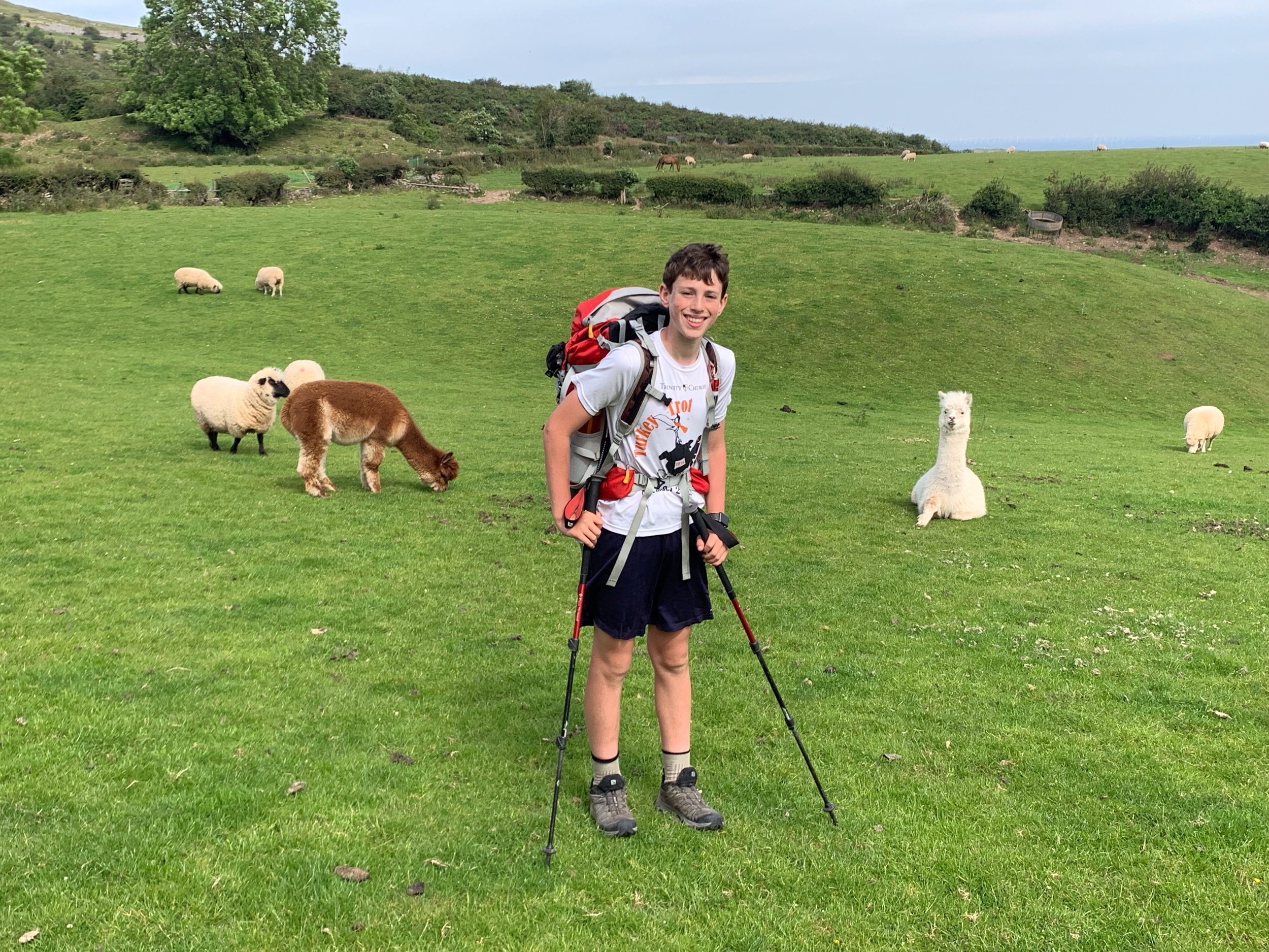
Then more fields, more sheep, more country roads, and even a couple of llamas! The llamas actually seemed fitting for Wales as the language has so many words that start with LL!

IMG_4112.jpeg
IMG_4117.jpeg
IMG_4134.jpeg

We also had some high grass and wheat fields we had to walk through. We were grateful that it had not recently rained because if it had, our legs would be drenched from rubbing against the tall grass/wheat.

IMG_4123.jpeg

And I always seem to talk too soon! I had read that there were confusing parts today in which it would be hard to follow signs for the ODP. Right after commenting to Lara that the signs were pretty easy to follow by just looking at the direction the arrows were pointing, we came to the section that the writer must have been describing! I knew the general direction we were to be heading, but it was vast with no markings, so we just headed North and hoped for the best. Fortunately we eventually found a sign and a stile to cross.

IMG_4125.jpeg

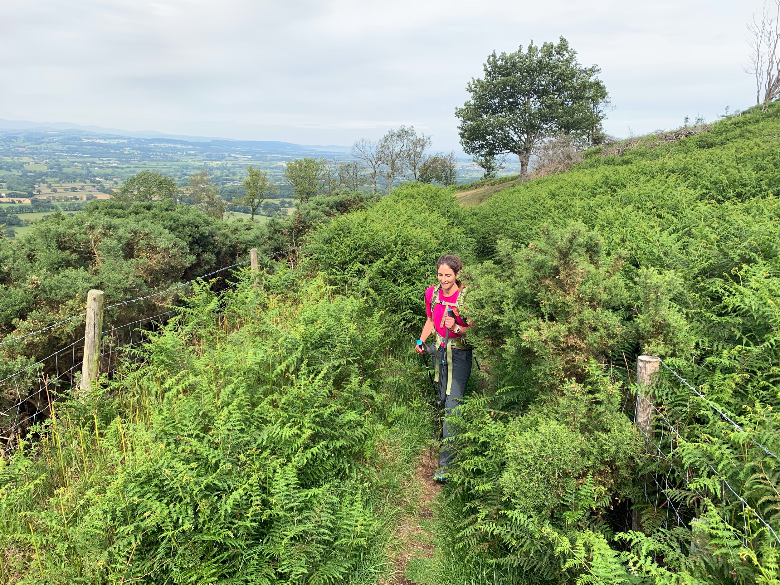
I also said at least 4 times that we were climbing our last hill of the trek. 3 of those times I was obviously wrong! Just as it seemed that we were cresting the last climb, the path would turn to avoid roads and take us over another hill. We were all in good spirits though, knowing that we were almost there, so we didn’t mind too much these last few climbs.

IMG_4114.jpeg

As if all of the animals were bidding us adieu, we had one more chance to see some cows in one of the very last fields of our trek. And right on the path were a mother and baby calf! 

IMG_4142.jpeg

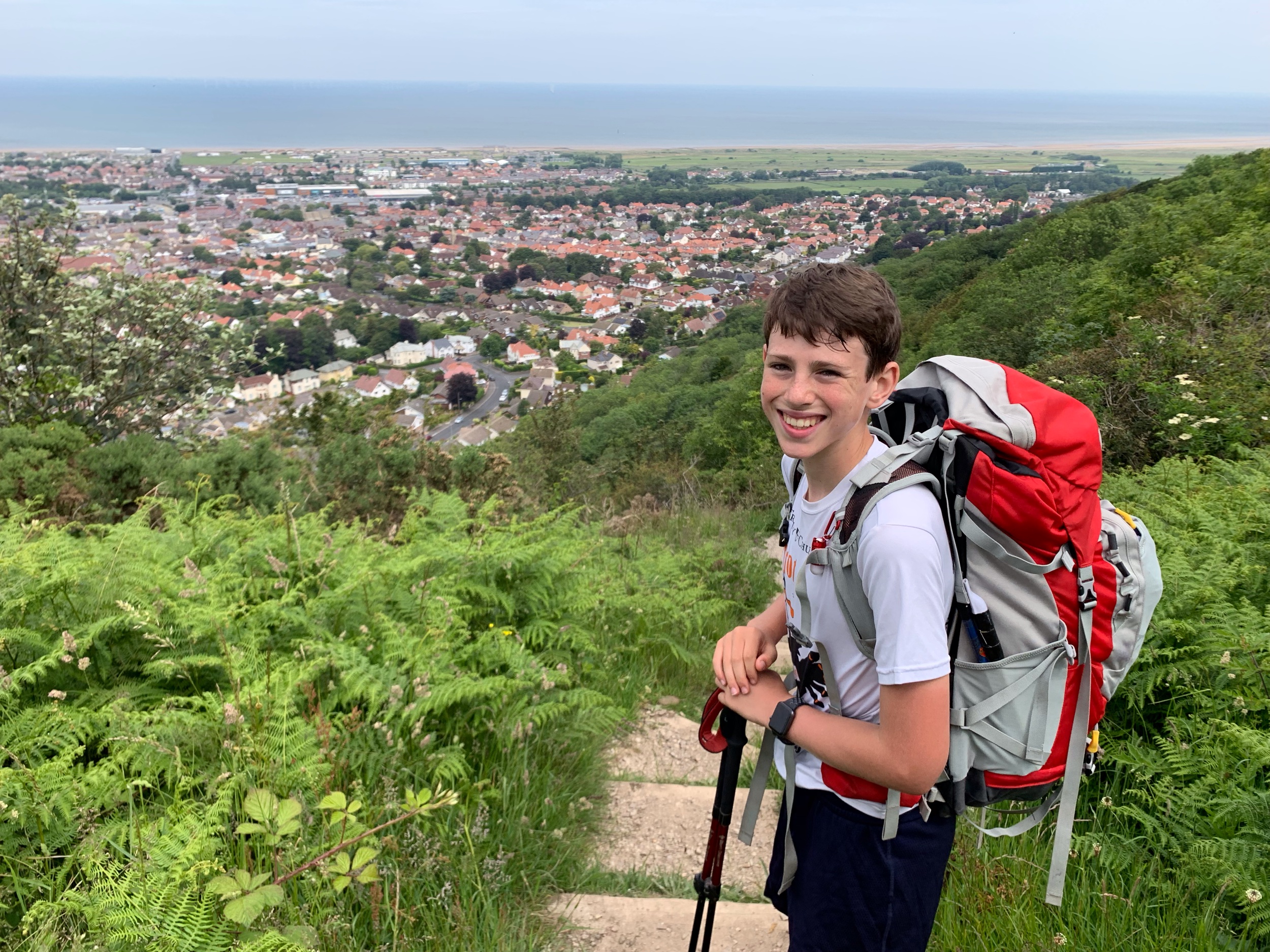
We knew we were getting very close as the town of Prestatyn and the Irish Sea came in full view.

IMG_4149.jpeg

And then we turned a corner and had yet another climb! This one would actually be our last one of the trip.

IMG_4151.jpeg

Jonah was thrilled to see these last steps as we approached the town proper.

IMG_4154.jpeg

And once we made it into the town, it was easy to follow the path since every post had these circular acorn signs.

IMG_4156.jpeg

And there were even some acorn signs in the sidewalk!

IMG_4158.jpeg

Finally, at 12:20 we made it to the water! We were expecting some fanfare, but all we found was this sign with the wrong total distance on it. Interesting, the other end had the wrong distance too, but a different total! There actually is another metal statue of an O, but it didn’t have anything about the ODP on it so we weren’t sure at the time whether it was related to the hike.

IMG_4161.jpeg

And then we went to the water’s edge and took the ceremonial photo of the front of our shoes in the water.  Had we been at the water’s edge in Chepstow we would have done the same, but since we were only on a cliff overlooking the water, we couldn’t.

IMG_4174.jpeg

Because we only had 40 minutes before our train, we had a quick celebration and another photo at the water’s edge.

IMG_4177.jpeg

We then went into the building at the end (Nova building) and signed the registry as having completed the ODP. Lara was dehydrated and needed some sugar, so we went to a store to get her some. While there, Jonah and I got some dairy-free ice cream!

IMG_4181.jpeg

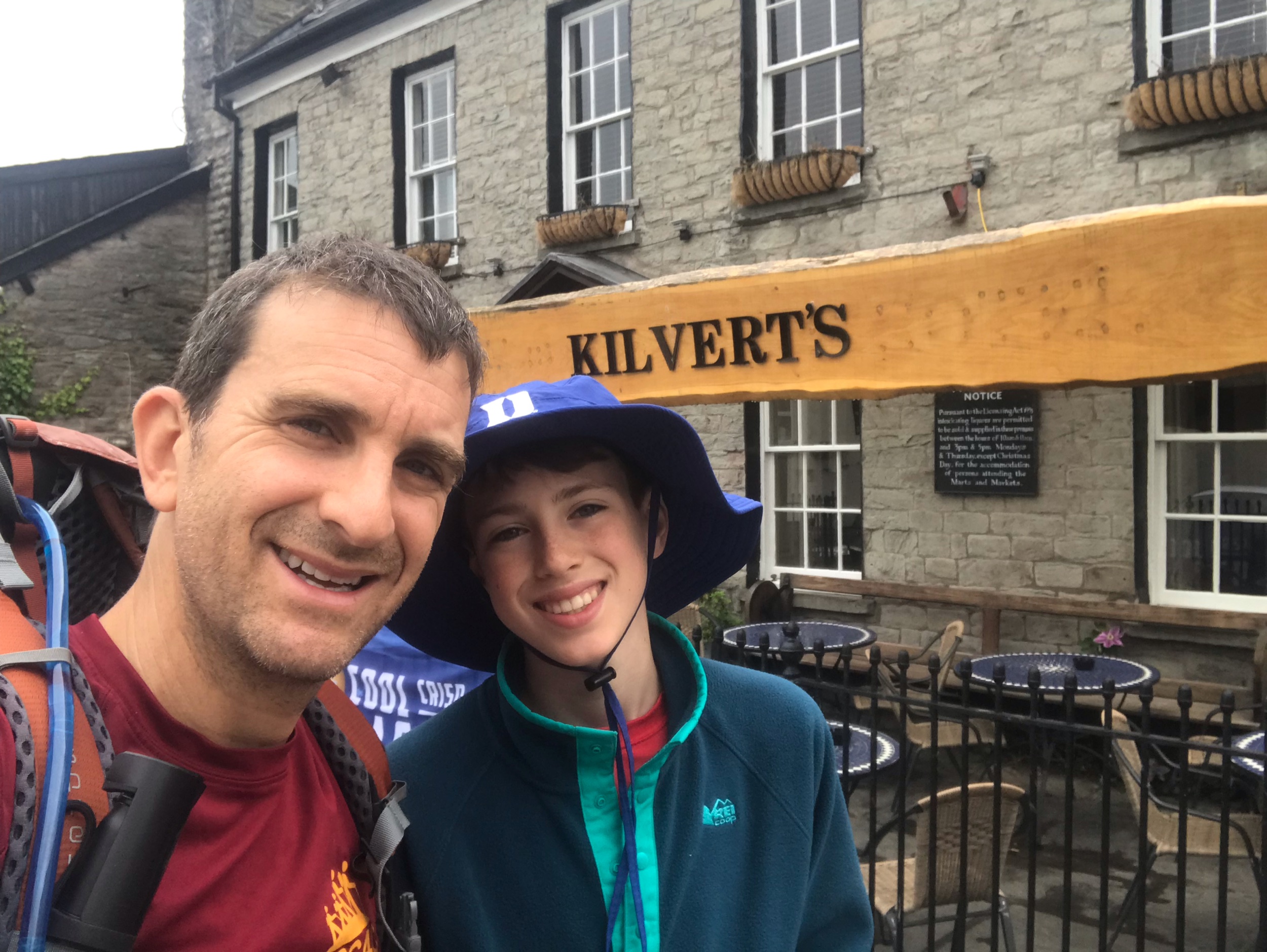
We made it to the train station with 10 minutes to spare. It was only a 90 minute ride to Manchester (including a quick train change in Chester). Our lodging for the night, Premier Inn at Manchester Piccadilly, was just a short walk from the train station. Our running joke is that we are staying at the premiere hotel in the UK (hence the #1 sign we are holding up.)

IMG_4188.jpeg

They clearly thought that Jonah was a bit younger than he actually is!

IMG_4189.jpeg

Yet another c2c4c tradition is the post hike shave. I don’t shave for the entirety of the trek - go all grizzly - and then finally shave after our last day’s hike.

1DCF0875-38AF-4DF3-84EE-7F83FD5FE761.jpeg

We were hungry so went to dinner at 5:15 PM. Jonah just wanted to chill in the room so picked up a vegan patty at Subway and stayed back. Lara and I found a fun pub/restaurant with several vegan options. 

IMG_4203.jpeg

We ordered the deep fried cauliflower burger - not the most healthful option, but after almost 200 miles of hiking we weren’t worried about eating healthfully!

IMG_4204.jpeg

After dinner we relaxed in the room. I took the opportunity to catch up on my blog from Day 13. By 9 PM we were ready to sleep since we need to get up early for our flight home.

Daily Stats

Distance: 11.81 miles

Time: 4 hours 01 minutes

Average Speed: 2.7 mph;

Total Ascent: 2,079 feet

Total Descent: 2,355 feet

Day 13: Llandegla to Bodfari

(No wifi at lodging so posted a day late)

We knew that our penultimate day would be our ultimate challenge so we were determined to get an early start.

We had a filling breakfast of granola, porridge, fruit and non-dairy yogurt, beans and toast, avocados, grilled tomatoes, mushrooms, and potatoes topped with vegan cheese!

195670ED-0415-426F-BC46-0A973C3571E0.jpeg

Knowing it would be a long day with few opportunities to pick up food, we ordered packed lunches for the day. By 9 AM we were on our way, saying goodbye to our comfy lodging at the Grousemoor Inn and ready to attack this beast of a day with gusto.

IMG_3863.jpeg

Lodging only 3/10 of a mile from the route, we soon caught back up with the ODP just before entering the actual village of Llandegla.

IMG_3868.jpeg

And as we were leaving town, we saw this promising marker reminding us of how much we have accomplished so far and that we were a mere 29 miles from the finish line in Prestatyn!

IMG_3869.jpeg

Even though the glorious sun was shining bright, early on we occasionally could see remnants of the rain that had battered the region over the past couple of weeks.

IMG_3872.jpeg

The early part of the day’s trek was through gently inclined fields.

IMG_3875.jpeg

We also walked some paved trails surrounded by vast scenes of beauty.

IMG_3876.jpeg

About 90 minutes into our trip, we saw our first of many groups of young hikers of the day. As this was a beautiful Saturday in June, many school groups (most with only students, no teachers) were walking these incredible trails. While there was a part of us that wanted the peace and solitude of the past 12 days hiking, we certainly were happy to trade that in for the weather we were blessed with this day. 

At this point, the real journey was about to begin along the undulating ridge of the Clewydian hills: the narrow range dividing industrial Deeside from rural Denbighshire. Our first real climb of the day was this one behind us, heading up to the western ridge of Moel y Plas.

IMG_3879.jpeg

We took our first of several breaks today when we reached the top. The views were spectacular, so we took the opportunity to take our bags off and then play a little ukulele/tin whistle duet!

IMG_3887.jpeg

And then we pushed on along the ridge, taking the occasional stop for a photo.

IMG_3890.jpeg

If I had entertained my urge to take a photograph every time I was amazed at the landscape, our hike today would have been significantly longer - we were surrounded by natural beauty all day.

IMG_3891.jpeg

And we happily trekked along the well-marked path.

IMG_3895.jpeg

As has been the case along the ODP, sometimes we had local guides leading the way. 

IMG_3898.jpeg

This little guy kept sneezing; it sounded just like a human sneeze!

IMG_3904.jpeg

We often found ourselves walking on these narrow trails.

IMG_3910.jpeg

And when we came to more open fields, they were well-marked green lanes. It almost looked like they had been spray painted green, but they weren’t.

IMG_3927.jpeg

Jonah wasn’t too thrilled about having to climb this mountain.

IMG_3934.jpeg

We decided to take another water/snack break before we made our way up Foel Fenlli.

IMG_3938.jpeg

The climb wasn’t as bad as it looked - steep but brief. And once we got up, the path rounded its way around several mounts.

IMG_3949.jpeg

We then started to descend the other side.

IMG_3958.jpeg

After being out in unobstructed nature for the past few hours, we found the car park that we came to (destination of many school groups) with this cart a bit jarring.

IMG_3959.jpeg

In retrospect, we wish we would have replenished Lara and Jonah’s water bottles here as we ended up running out of water with 3-4 miles left of our day’s hike.

IMG_3961.jpeg

And then we entered Moel Famau County Park.

IMG_3963.jpeg

We started the next phase of our day’s journey, up to the summit of Moel Famau, the highest summit in the Clwydian Range. We could see the summit viewpoint from far away. It attracts about 200,000 visitors annually.

IMG_3965.jpeg

It was a long steady climb to the top, Jubilee Tower, but knowing that we would be taking a lunch break when we reached it gave us enough energy to keep on hiking! And when we got there, we saw this sign letting us know that we were a mere 20 miles from the end point of the ODP!

IMG_3966.jpeg

The tower has been restored in the past few years, but it isn’t much, especially compared to the original - a two-tiered Egyptian-style edifice constructed in 1810 to celebrate the golden jubilee of George III. It still provides a good stopping point for photos.

IMG_3968.jpeg
IMG_3974.jpeg

It also is a great spot to get a panoramic view of the surrounding region.

IMG_3972.jpeg
IMG_3971.jpeg

While Jonah and I climbed the remains of the tower for views and photos, Lara lounged below with views of the trail that we were about to take.

IMG_3976.jpeg

We had our packed lunches - sandwiches, chips, apples, and cookies - and then got ready to continue our journey.

IMG_3978.jpeg

The guide book lists the day’s climb at 2,870 feet so we thought that we were almost done climbing (we had already done over 2,500) and would be spending the rest of the day heading down to our destination. In what felt like the worst typo in the history of typos, the book likely accidentally put a 2 instead of a 3! While we had done over 1/2 of our climbing for the day, we still had a lot of climbing to do! Shortly before 2 PM we started the next leg of our journey.

IMG_3987.jpeg

Lara had promised to continue telling Jonah the story of the book she had just finished, The Woman in Cabin Nine. Since it is on my list of books to read, I spent the next couple of hours in front of them, happy to walk in silence and just take in the surrounding beauty.

IMG_3989.jpeg
IMG_3990.jpeg

This separation also gave me more opportunities to look back to them and see the views from another direction.

IMG_3991.jpeg
IMG_3995.jpeg

This region is known for its hillforts, including this one at Moel Arthur, which was occupied for several centuries starting in the Bronze Age!

IMG_4002.jpeg

After climbing up to another hillfort, I needed a break so I sat against this slate sign and waited for Lara and Jonah to join me.

IMG_4005.jpeg

By the time they did, Lara had finished telling her story and we were able to finish the day walking as a threesome again.

IMG_4009.jpeg

At this point we thought/ hoped we were definitely done with the climbing as it looked like we were heading down with spectacular views.

IMG_4011.jpeg
IMG_4013.jpeg
IMG_4014.jpeg

But we were wrong again, as we started yet another climb up toward the hillfort of Penycloddiau, which at one time was one of the largest in Wales. We just got to this rock formation and a slate sign.

IMG_4017.jpeg

And then we truly were heading down. 

IMG_4025.jpeg

It was a good thing we were because we were out of water and were all exhausted.

After a mile or two of hiking with weary legs, Jonah somehow got a burst of energy. Having the end in sight definitely helped, and his energy had a ripple effect as it gave Lara and me the energy needed to complete our day.

IMG_4026.jpeg

We still had walking to do, and once we entered the town of Bodfari, we had to climb a paved lane with a major incline. But we did it! And we arrived at our B&B for the night, Llety R Eos Ucha at 5 PM!

IMG_4035.jpeg

A door had our name on it, and it was open, but no one was at home. There was a note on a table letting us know that there was no wifi and that the nearest (and only) eatery nearby was 0.8 miles walk away and that it gets packed, especially on a Saturday night, so it would be good to make reservations. Unfortunately there was no phone and no wifi. We unloaded our packs, took showers and tried to figure out what to do. By then, the owners had returned and explained that it would be best to just go to the restaurant as we would more likely be served that way. So we walked down the hill and across the field to what turned out to be the only happening place in town -it seemed that the whole small town must have been there! It was packed, by the time we arrived at Dinorben Arms at 6 PM. 

IMG_4067.jpeg

Fortunately, it was a nice evening and no reservations were needed to eat at the outdoor seating on the rooftop. We ordered A LOT of food and then reviewed our day as we waited for it to arrive. This turned out to be the most miles we have ever hiked in one day on a C2C4C trek, the second most feet climbed, and the most descended. The only reason it wasn’t the most hours hiked was that we went at a significantly slower pace on our first trek across England when the kids were 10 and 12 years old. Today’s hike was really incredible and might have ranked as our favorite of the trip had it not drained us so much by its length. And the weather was wonderful, if a little hot. But after the 10 days of rain we experienced to start our journey, we are definitely not complaining!

The food arrived and was as good as the atmosphere. We ordered two veggie Thai curry dishes, hummus and bread, warm fresh bread with olive oil, 3 orders of fries - pretty much everything vegan on the menu.

IMG_4063.jpeg

Even though we had not been looking forward to the long walk uphill back to our lodging, by the time we finished, we knew we needed some walking to digest our food. We were amazed at how much energy Jonah had skipping home. We were also amazed at the sock tan line he got from just one day of pure sun!

IMG_4073.jpeg

As we continued our walk home, Jonah asked for a word from which he would do some rap lines. We kept giving him words and he kept coming up with raps. While we love anything he does, we don’t think he has much of a future as a rapper! ;-)

We were exhausted after our long day and, after watching a couple of episodes of “How I Met Your Mother”, went to sleep.

Daily Stats

Distance: 19.07 miles (not including 2 miles walking to and from restaurant for dinner)

Time: 7 hours 02minutes

Average Speed: 2.7 mph;

Total Ascent: 3,913 feet

Total Descent: 4,373

Day 12: Froncysyllte to Llandegla

Happy Summer Solstice!  The longest day of the year also happened to be our favorite day of the hike!

I’m starting to get tired of waking up at 5 AM to write my blogs but am always happy that I have them in the end. I woke the others up at 8 in time to get everything ready before our 8:30 AM breakfast. We had the usual fare but took our time since we knew the sun would be shining today and the hike would be shorter than usual. By the time we started our hike, it was 9:45 AM. 

IMG_3639.jpeg

Fortunately, our lodging wasn’t far off the ODP so we quickly and easily rejoined the trail on the Llangollen Canal towpath. 

IMG_3640.jpeg

We were all in good moods and shared many a laugh along the canal. While these carts were once used to tow rocks from the quarry, Jonah decided it might be easiest to have Lara tow him the rest of the way! ;-) 

IMG_3647.jpeg

Walking along the canal we could see the Pontcysyllte Aqueduct in the distance.

IMG_3643.jpeg

While crossing the aqueduct is not part of the official ODP, there is an alternative route that allows hikers to walk across and rejoin the route, it’s a minor diversion and doesn’t add much distance or time.

IMG_3648.jpeg

As Britain’s highest navigable aqueduct, about 130 feet above the River Dee on 18 piers, the Pontycysllte Aqueduct actually doesn’t support the canal system for which it was built. Meant to connect the Severn, Dee, and Mersey rivers, the plan was abandoned when money ran out. It now just connects two canals.

IMG_3656.jpeg

Soon after we crossed the aqueduct, we reconnected with the main branch of the ODP.

IMG_3662.jpeg

After climbing on some roads and through some fields, we entered Trevor Hall Wood, a coniferous woodland where we continued to climb.

IMG_3667.jpeg

We had such a variety of terrain and scenery today. It made for a very enjoyable hike. We had our share of fern lined trails.

IMG_3669.jpeg
IMG_3670.jpeg

And the views were generally inspiring.

IMG_3671.jpeg

We also spent quite a bit of time on farm roads.

IMG_3672.jpeg

These two gave us plenty of opportunities to break and take in the views.

IMG_3675.jpeg

Derek, who owns Glen Coed B & B, let us know that we’d have quite a long haul on paved road. The maps seemed to show that too, so we were expecting to have to deal with what is our least favorite type of path. While the road he was speaking of was long (about 2.2 miles!) and paved, it was actually quite wonderful as it was a well-paved single lane path. We only saw one runner, one bicyclist, 2 bikers, and a few people in cars. It is quite long, undulating, and appropriately named Panorama Walk.

IMG_3679.jpeg

We eventually passed to the right of Castle Dinas Bran, seen here in the upper left corner.

IMG_3681.jpeg

It was an Iron Age hillfort castle constructed in the 1260s, captured during Edward I’s advance into North Wales and eventually abandoned in the 1280s. As we continued past Dinas Bran, we came across these sheep, who scurried past us.

IMG_3685.jpeg

Shortly afterwards, we spotted the smallest lamb we have seen on the trip - so small and cute that it reminded us of our cat Toby!

IMG_3686.jpeg

On our right, we started to see the majestic cliffs of Creigiau Eglwyseg and then left the paved road and started climbing a rough track that curves underneath the cliffs.

IMG_3691.jpeg

This part provided yet another terrain for us to enjoy! 

IMG_3696.jpeg
IMG_3698.jpeg

As we started to get close to 1 PM, we all were ready for a snack break of PBJ on toast and fruit that we had packed from breakfast.

IMG_3703.jpeg

While hunger was definitely a factor in the stopping, my sore shoulders were even a bigger reason to stop. The weight of my pack has started to get to me and each night I have been dreaming of future hikes with a lighter pack, lighter gear, and fewer items too. I think I could shed 10-15 pounds of weight - that would make a huge difference to how my body feels. We originally got these packs 4 years ago, and I specifically got a large one so that I could take extra weight on from Lara and the kids when they got tired. Four years later, I don’t need to take as much from them and Lara and I have talked about paring down what we take. On our last blog of the trip I’ll list recommendations for traveling lightly on a multi-day hike.

For this moment though, I was just happy to have a few minutes to lay back and relax.

IMG_3714.jpeg

And Jonah provided some tin whistle entertainment!

IMG_3718.jpeg

It’s incredible what a 15-minute break can do for the body and spirit! Jonah was confident that my pack wasn’t too much heavier than his, so I let him try mine for a bit.

IMG_3722.jpeg

That didn’t last too long! We soon switched back and headed down off the mountains and back on to a dirt trail.

IMG_3723.jpeg

Soon enough we were back on paved road and came to this spot that is called World’s End!  If this is what the end of the world looks like, I’m not as worried as I thought I’d be!

IMG_3729.jpeg

And then we came across this pair of sheep relaxing at the edge of the road. Amazingly they stayed put as we went by.

IMG_3741.jpeg

Continuing along the country lane, we came to this stone sign, one of many such signs we have passed along the ODP. It says Offa’s Dyke Path in Welsh.

IMG_3761.jpeg

Jonah was happy when we next came to this stone sign as it informed us that we were only a couple of miles from our destination.

IMG_3762.jpeg

We turned off the road and were greeted by yet another type of terrain! The path had some parts with large stone slabs.

Jonah and I were paying tribute to our Duke Blue Devils, who went 1, 3, and 10 in the draft.

Jonah and I were paying tribute to our Duke Blue Devils, who went 1, 3, and 10 in the draft.

Some parts had railway sleepers providing  a boardwalk across damp and dry parts of the route.

IMG_3773.jpeg

We mistook the ladder stile for a kissing gate so Lara and I kissed on top of it. Any excuse to kiss my beautiful wife is fine by me!

IMG_3778.jpeg

After walking past a clear-felled tree plantation, we entered this plated evergreen forest. It was truly magical and majestic. I took photos, but there really was no way to capture the true beauty of this part of our day’s hike. 

IMG_3784.jpeg
IMG_3787.jpeg

As we came out the other side, walked by another area of felled trees. I was amazed to see these beautiful foxgloves flourishing. Somehow it gave me a sense of hope and happiness about our future. Even as things seem dire, new life and beauty always manages to spring up and promise a brighter tomorrow.

IMG_3806.jpeg

And then at about 2:45 PM we arrived at our destination for the day, The Grousemoor Inn. 

IMG_3807.jpeg

While the outside didn’t seem like it was anything special, as soon as we walked in we knew that we would be in for a treat. This is definitely our most luxurious accommodations for the trip. And it seems a fitting way to end what Lara and I both feel has been the best hiking day of the trip. Sunshine from start to end, diverse terrain and scenery, amazing views, and just the right amount of elevation change and distance conspired to create the perfect day of hiking. 

Howard, the Inn’s manager has catered to our every need and has made sure that there are plenty of great vegan options for us for each meal. We have a 2 bedroom, 2 bathroom suite with a living room/kitchen that includes a washer/dryer! So we are cleaning anything that smells remotely like mildew as most clothes do after being through the wet conditions we’ve had for the past week.

After showering, we went down for a late lunch: vegan cheese sandwich, Jackfruit sandwich, a salad, and cappuccinos!

IMG_3809.jpeg

Then we relaxed for a bit in our suite.

IMG_3849.jpeg

After relaxing in the room, we were back a little after 6 for some dinner - a special gnocchi and vegetable dish followed by vegan chocolate desserts. 

IMG_3836.jpeg

When we got back to the room, Lara and Jonah took baths while I wrote this blog (tomorrow is a LONG day so I don’t want to get up earlier than necessary to write it in the morning!) It’s now 9:30 PM, and time for my bath before we all get a good night’s rest.

Daily Stats

Distance: 12.04 miles 

Time: 4 hours 18 minutes

Average Speed: 2.8 mph;

Total Ascent: 1,999 feet

Total Descent: 1,482 feet

Day 11: Trevonen to Froncysyllte

Extra points if you can pronounce the name of the town in which we are lodging tonight. I’ve heard it pronounced a few times and I still can’t say it!

I woke up a bit early to plan out the day’s hike and then, at 8 AM, walked over to Lara and Jonah’s B & B for the night. I was surprised to find Lara awake already and not surprised to see Jonah still asleep.

After getting their gear packed, we went down for a wonderful breakfast - that’s what comes with staying at the B & B of a caterer!

1280088F-DCCE-4B2E-B1C0-0C5341C9FF16.jpeg

Not only porridgeand granola, but also avocado toast, mushrooms and fresh cut tomatoes.

IMG_3475.jpeg

Just after we ate, it started to rain. Nothing too dramatic, but it did make us not in so much of a rush to leave. By the time we finished packing and said goodbye to our host, Pam, this sun was out again. The sun brings life and energy to everything and everyone!

IMG_3478.jpeg

Today was probably our easiest day of the trek. We had our fair share of fields to cross but they were pretty well-maintained.

IMG_3480.jpeg

We did pass this bull with his lady, but he didn’t bother us.

IMG_3484.jpeg

And we had some country lane walking too, but on a beautiful day, we are happy to walk on anything!

IMG_3487.jpeg

Then we hit our first ascent of the day, up through a wooded area on a well-kept trail -still smiling! 

IMG_3489.jpeg
IMG_3491.jpeg

I took a quick break when we reached the top to enjoy the views.

IMG_3492.jpeg

And then it was onwards through a mature forest that provided nice shade - I believe this is my first mention so far of looking for shade cover! This forest is known as Candy Woods - Jonah definitely searched but didn’t find any candy!

IMG_3499.jpeg

We reached this spot, which was originally built in 1804 as the Oswestry Racecourse Grandstand. As you can see, there is not much racing here anymore!

IMG_3501.jpeg

We had been told that it was supposed to rain at 10 AM, but had hoped that it had come early when it rained just after breakfast. Unfortunately not! We got hit with some heavy rain about an hour into our hike, so we decided to put on raincoats and bag covers. Ironically, by the time we had made the switch, the rain stopped and stayed away for the rest of the day!

IMG_3503.jpeg

Twice today we came across ODP marked gates with no fence - we assumed that these were fenced plots at some point!

IMG_3505.jpeg

And we did see our daily quota of sheep. I especially liked the view of this group on the horizon.

IMG_3506.jpeg

And then more hills to climb! We can tell, not only by his look but also by what he tells us, that Jonah is just powering through at this point - #TSBT! 

IMG_3508.jpeg

One of his favorite parts of these trips is the family time, especially being able to be goofy with his sister. He’s still goofy with mom and dad, but it’s not the same for him. With Olivia leaving early, Jonah loses out on the companionship too. So while Lara and I are enjoying each moment, at this point he’s counting down the days and miles until he crosses the finish line. We generally try to stay away from technology on these trips, but podcasts have really helped him get through some of the tough times. When he wants to be on his own and push through, he tends to walk ahead and listen to sports podcasts that he downloads the night before. The difficulty he is now facing with his sister’s departure is a reminder that in a group dynamic each member is critical to the whole. And the whole is just as strong as each individual part. When you take one part away, it can be hard for that not to affect what remains.

IMG_3510.jpeg

We started a descent down a well marked path along the dyke.

IMG_3520.jpeg

And in the distance we could easily see our lunch break spot in the distance, Chirk Castle.

IMG_3525.jpeg

As we hiked down, we passed a few beautiful and friendly ponies.

IMG_3528.jpeg

Chirk Castle is actually up at the top of a hill. The ODP actually skirts around the castle instead of climbing up to it. Since it was a beautiful day and would be one of our shortest hikes of the trip, we took an alternate path that climbs up to the castle.

IMG_3537.jpeg

After eating the hummus sandwiches that we had purchased from Pam before leaving this morning, we explored the castle and the grounds. We were grateful to be able to leave our packs in a locked room near the ticket desk so that we could walk around unencumbered.

IMG_3568.jpeg

Completed in 1310, Chirk Castle, with it’s strategic and very visible ridge-top site, was Edward I’s last statement of power over the Welsh.

IMG_3578.jpeg

In 1595, the castle was bought by Sir Thomas Myddelton for £5000. His descendants have lived in it ever since. Today there is still one relative who occasionally stays in one tower of the castle, but the remainder has been taken over by the National Trust.

IMG_3562.jpeg

The formidable defensive walls and tower remain as they originally were built, as does the dungeon. We sent Jonah to the dungeon, but eventually let him out!

IMG_3548.jpeg

A lot of the inside has changed dramatically over the centuries. There is 17th-century gallery, an 18th-century saloon, and a 20th-century library. We spent an hour and a half exploring the rooms and the grounds. 

IMG_3564.jpeg
IMG_3570.jpeg

And then we made got our packs and were back to hiking. In under a half-mile we met back up with the ODP. With the sun shining and the day’s hike nearing its end, it was time to break out the ukulele to bring us home!

IMG_3581.jpeg

As I continued to play, Jonah and Lara dropped back so that Lara could continue telling Jonah a story.

IMG_3588.jpeg

We walked for a mile or two on a peaceful country lane.

IMG_3587.jpeg

And then at about 3:30, we reached our destination for the night: Glen Coed B & B!

IMG_3590.jpeg

I feel the most refreshed I have felt at the end of day’s hike since the trip began. The sun, long break at the castle, and short distance has that effect! After showering and resting for a bit, we walked 1/2 mile into town for dinner at the Aqueduct Inn and Pub. 

IMG_3612.jpeg

The patio presented nice views of our next day’s hike.

IMG_3607.jpeg

Two vegan options on the menu; we had both!

59E04FD1-0B60-475B-8256-97ABFCEE61C6.jpeg

After dinner, we walked back to our lodging to relax and get ready for bed. At this point fatigue started to set in. Jonah had his own room for the night - pretty sure he stayed up late to watch the NBA draft. Lara and I went to bed early.

Daily Stats

Distance: 11.11 miles (not including all of the walking we did at Chirk Castle or the mile walk to/from dinner)

Time: 4 hours 00 minutes

Average Speed: 2.8 mph;

Total Ascent: 1,929 feet

Total Descent: 2,217 feet

Day 10: Pool Quay to Trefonen

I was up just after 5 to finish the blog and upload pictures. Unfortunately it took me a couple of hours to get everything uploaded, but at least I was done before breakfast! And I could here Andy toiling away in the kitchen - another early riser.

IMG_3319.jpeg

I got Lara and Jonah up a little after 8 AM so we could be ready for our breakfast at 8:30 AM. We had a standard English breakfast, but Andy did a more traditional bean option, which we haven’t had before. He put the beans on the toast - delicious! We will definitely be taking that idea home with us!

IMG_3318.jpeg

By the time we were packed up and ready to go it was about 10 AM - we couldn’t get into our next accommodations until after 3 pm so we were in no rush for an early start.

IMG_3321.jpeg

Though the rain kept a distance this morning, the puddles were in full force - some were even so large that they had inhabitants! 

IMG_3323.jpeg

And mud pits were everywhere!

IMG_3326.jpeg

The first 6 miles today were flat - we spent much of it paralleling the River Severn. 

IMG_3329.jpeg

While it wasn’t hilly, it was still difficult. Mentally it felt even more challenging than hills. We had to watch each step for the puddles, mud, and animal poop. And we also had to go through many fields that had not been cut, so we had to take higher steps than normal.

IMG_3331.jpeg

And our pants and shoes still got soaked!

IMG_3336.jpeg

We still had some beautiful mountains to look at.

IMG_3338.jpeg

However, the quarrying has had a major impact on some of the aesthetics as well as ecosystem.

IMG_3351.jpeg

We occasionally got a break from the unplowed fields, and were grateful for these stretches.

IMG_3348.jpeg

But more often than not, the break was to a field of mud instead of a field of mowed grass! (

IMG_3352.jpeg
IMG_3356.jpeg

And today was definitely more of a cow day than a sheep day. They tended to be right on the dyke with us.

IMG_3347.jpeg
IMG_3360.jpeg

We did see our quota of sheep though. And this group reminded me of our cats Mo and Toby. Mo spends a part of most days resting his head on Toby’s back like this.

IMG_3364.jpeg

We did have some light rain, but nothing worth putting rain clothes on for. And then after 6 blah miles, we joined back with the Montgomery canal.

IMG_3367.jpeg

While we spent too much time doing canal walking on our last C2C4C hike across Scotland, we were thrilled to get on the canal today and away from the tall grass and mud.

IMG_3370.jpeg

We didn’t have to watch where we were stepping. We set a nice pace, enjoyed the scenery, and listened to Lara finish her retelling of the movie, Arctic.

IMG_3373.jpeg

We started to get a bit tired after mile 8, so took a quick break.

IMG_3376.jpeg

And then after walking for three miles on the canal, we crossed back over the border into England.

IMG_3381.jpeg

At this point it was 1 pm and we were a bit hungry and tired so we took a 15-minute snack break. Jonah had a jam sandwich that we had made with the leftover breakfast toast while Lara and I split a Macro bar.

IMG_3383.jpeg

Right after our snack break, we had our first climb of the day.

IMG_3387.jpeg

We climbed about 300 feet up on a paved road and then through a wooded trail.

IMG_3391.jpeg

We came to the remains of a Welsh Brake Drum House from the early 1800s. It was used for moving rock-filled trucks up and down the mountain. For us, it just served as the beautiful spot for photos.

IMG_3395.jpeg

And a perfect location for a few handstands! 

IMG_3398.jpeg
IMG_3404.jpeg

And then we continued on our way up the trail. 

IMG_3407.jpeg
IMG_3410.jpeg

All was dandy until about 2:30 when the rain came. While we have had light showers almost every day, this is only the second heavy rain we’ve experienced so far. It started on one of our ascents up a farm road.

IMG_3412.jpeg

But we did have moments of in which it subsided too.

IMG_3416.jpeg

We alternated between road and pastures/fields at this point.

IMG_3417.jpeg

As we approached the nature preserve known as Jone’s Rough, we saw this sign, which reminded Jonah of one of his favorite Duke players!

IMG_3419.jpeg

Then it was back to climbing muddy farm tracks.

IMG_3427.jpeg

But the rain and mud couldn’t dampen my spirits - it was still a glorious day. I’d say that about any day I can be outside with my family.

IMG_3430.jpeg

And then we started our final descent toward the town of Trefonen, through fields and over streams.

IMG_3436.jpeg

We made it to our lodging for the night shortly after 3:30 PM.

IMG_3437.jpeg

Since the Dingle Cottage only has one room with two twin beds, Lara and Jonah stayed here. We all went in for some tea and a snack before I headed a few doors down to a neighbor who was putting me up for the night. After showers and some rest, I walked back over to the Dingle Cottage for dinner. The owner/host, Pam also happens to be a caterer. She had checked with the local pub and had not been satisfied with the vegan options so she made us a fabulous dinner - bulgar salad with other vegetables, sour dough bread.

IMG_7575.jpeg

And to finish things off she had made a coconut yogurt dessert with raspberries.

IMG_7577.jpeg

After days of chips and pizza, this was a bit too healthful for Jonah so I went to the local store and got him some Pringles, bananas, and peanut butter! With how well he’s been handling himself, he deserves to eat whatever he wants.

We got to speak to Olivia via FaceTime just after dinner. Her stomach is doing better and she is starting to get her energy back - all good news! I then said goodnight to my hiking partners and went back to my lodging to write my daily blog, watch a little TV, and get a good night’s sleep.

Daily Stats

Distance: 14.68 miles

Time: 5 hours 00 minutes

Average Speed: 2.9 mph;

Total Ascent: 1,417 feet

Total Descent: 1,026feet

Day 9: Mellington Hall to Pool Quay

If I had to give a title to the day it would be “You can’t judge a book by its cover.” From the outside, one would think that our stay at the estate of Mellington Hall would have been our best and most luxurious, but that was not actually the case. The rooms are basic and aren’t nearly the most comfortable we’ve had on this trip, the food was subpar with very few vegan options (including no soy milk for breakfast cereal), and the service painstakingly slow despite there being very few people staying there last night. That’s just an observation, not a complaint (Jonah strongly dislikes when I complain about lodgings or food service!) 

We had a serviceable breakfast at 8 and were out the door by 9:15 AM. Unfortunately it took my Garmin 15 minutes to connect so we didn’t actually leave until 9:30 AM.  We tried to get an early start because the forecast called for rain to start at 1 PM and we wanted to get as much road behind us before the rain came as possible.

IMG_3153.jpeg

We knew the day’s hike would be much flatter than yesterday’s. And it was, at least for the first half of the day’s trek. Lots of fields and pastures...

IMG_3155.jpeg

some trails through wooded areas...

IMG_3157.jpeg

and some walking atop the clearly defined dyke.

IMG_3160.jpeg

In one of the fields we saw these beautiful flowers - only time we’ve seen them on the trek - so had to take a picture. If any of you know what type of flower these are please let us know!

IMG_3166.jpeg

We were fortunate that there wasn’t rain as we passed through many of the fields with high grass or our legs would have been soaked!

IMG_3168.jpeg
IMG_3171.jpeg

As it was, they were just slightly damp as you can see from the lower part of my pants.

IMG_3174.jpeg

The scenery wasn’t quite as interesting today as it has been, but we were fine trading scenery for a day of reduced climbing. We passed the time listening to Lara recount the first season of Game of Thrones. She’s a great storyteller. Now Jonah and I want to watch the series -he has never seen it and I have only seen Season 1 many years ago. Even though the hike wasn’t as scenic, we still saw our fair share of pastures of sheep.

IMG_3176.jpeg

And some of them also strolled on top of the dyke!

IMG_3177.jpeg

Another time today when looks were deceiving relates to the bog/mud/swamps we encountered. As this was a clear day with no morning showers, one would think that the trail conditions would have been slightly better. Not the case - today was definitely the worst trail conditions - we had to go through quite a few pools of water and lots of mud pits.

IMG_3188.jpeg

And then we came across this sign and had to take a picture of it! 

IMG_3191.jpeg

While we have been amazed by the kindness of many of the people we have met on our adventure, we are even more amazed by how ignorant, selfish, stubborn, and divisive so many have become. We should be more like dogs and love unconditionally.

It took about 2 hours of hiking before we saw our first climb. When we got to it though, our legs and backs were not so happy. Yet another time in which the looks were deceiving. From the elevation chart one would surmise that it would be an easy day. However, our bodies are tired and backs/legs sore. So even though we had only 1/3 of the elevation as yesterday,our bodies were feeling each step more.

We did have some road hiking today, but didn’t mind it since it was easier than hiking on muddy trails.

When we headed off the road, we came across the small flock of sheep, one of which was black. It made me realize that we have only seen a couple of black sheep on our journey - not sure the reason for it. But come on sheep, let’s get a little more diversity! It’s 2019!

IMG_3203.jpeg

A little after noon and after having hiked 8 miles, we decided that we needed a little snack break. We could see that we were about to do another steep climb and our bodies needed a rest before doing so. We only took a 10 minute break, but it was enough to give us the necessary energy to put our packs back on and venture forth.

IMG_3206.jpeg

When we got to the top of the hill, we entered a wooded area - beautiful!

IMG_3209.jpeg
IMG_3211.jpeg

Lara hasn’t taken many handstand photos, but these woods were calling her so she obliged us with a couple of poses.

IMG_3215.jpeg
IMG_3217.jpeg

And then it was 1 PM and like clockwork, it started to rain. Though it was supposed to rain for the remainder of the day, we were fortunate that it only rained for about 15 minutes. And then we were hiking through fields up another hill.

IMG_3225.jpeg

We were hiking up for quite a while, so when we reached the top, we took a pit stop at Beacon Ring.

IMG_3228.jpeg

Beacon Ring is the site of a late Bronze Age and early Iron Age large circular hill fort, but it is now planted with beech trees. In older times beacon fires would have been lit here, hence the name.

IMG_3231.jpeg
IMG_3234.jpeg

When we came out the other side of the ring, we were met with some really muddy trails!

IMG_3237.jpeg

After passing out from these trails we were in fields with great panoramic views.

IMG_3238.jpeg
IMG_3242.jpeg

Lara wasn’t too pleased that there was no clear markings in the fields so we just had to find our way through high grass.

IMG_3240.jpeg

Heading down of the mountain we came across this stile/bench and took a photo because the engraving was just too perfect.

IMG_3245.jpeg

Here’s a close up of the engraving on the stile:

IMG_3246.jpeg

The latter part of the day was filled with lots of laughter! Lara started to tell the story of a movie she saw on the plane, Arctic, about a Norwegian scientist. And we learned that Jonah doesn’t yet know where Norwegians live! He guessed “Norwegia”! That started a fun game and silly game we played with him of “Where do they live?”  Then she started back on the story but we kept making jokes and silly asides so it took the rest of the hike to get through the first part of the story. 

Back to the hike - we finally came out of the fields and to the edge of Buttington, a fairly large town for the area.

IMG_3254.jpeg

Fortunately we were able to circumvent much of the town and were on a path in which Lara befriended a donkey.

IMG_3265.jpeg

And, of course, I befriended some cows.

IMG_3268.jpeg

We knew we were getting close when we left Buttington and found ourselves hiking on the flats next to the River Severn.

IMG_3273.jpeg

We even encountered some swans!

IMG_3275.jpeg

And then we were onto the Montgomery Canal for one final stretch.

IMG_3279.jpeg

We finally arrived at the Powis Arms, our destination for the night, a little before 3:30 PM.

IMG_3281.jpeg

From the look of the place, one would surmise it was a bit run down and wouldn’t be very hospitable - but once again, looks can be deceiving! I had even read some reviews yesterday (so that I knew what to expect as far as food options) complaints about it being run down, basic, loud, and inhospitable. Those reviews couldn’t be further from our experience and were most likely just based on outward looks. Andy, the manager, has been misjudged from his looks - one of the reviews characterized him as a gruff bouncer type. That also couldn’t be further from our experience. He came out and warmly welcomed us and is the first one on the trip to offer newspaper for us to put in our hiking boots - that helps dry them. And he also kindly offered to do our laundry! He also made a great effort to satisfy our vegan diets. He said he had to do some research to figure out what vegan was and where to get food but found some options at a few area markets. There are no Trader Joe’s or Whole Foods around in remote areas like these, so providing a variety of choices can be a bit more challenging. And we are only the 2nd vegan group who have come here in the 5 years he has owned the Powis Arms. We were extremely grateful for the effort he put in to making us feel at home. Since we knew he had bought food just for us, we wanted to fill up so he wouldn’t be left with a lot. Before going to our room to freshen up we put in an order for vegan chickenless nuggets, vegan fish cakes, and vegan fish strips.

We went up to our family room (double bed and bunk beds) and took showers. We felt much better after that! The building is over 500 years old, so it has history and charm built in. Like many of the old houses we have been in on the trip, the door heights are very low!

IMG_3296.jpeg

After showers, we came down for our snacks, which suited us perfectly. Then we put in a dinner order that would be ready by 6: vegan pot pie, vegan curry, veggie burgers, chips and fritters. After relaxing for a bit we came down for round two! By this time several locals had come in to the pub for drinks. We enjoyed spending some time in a local place where people come to enjoy a pint and some laughs after a day’s work.

Andy asked me to place some music after dinner, so I brought down my ukulele and spent an hour or so playing some tunes. It was a nice way for us to end the day. 

IMG_3303.jpeg

Then Lara folded the laundry and read her kindle while I wrote my daily blog. I tried to upload photos, but the internet speed was very slow so we called it a night instead.

Daily Stats

Distance: 14.71 miles

Time: 5 hours 16 minutes

Average Speed: 2.8 mph;

Total Ascent: 1,512 feet

Total Descent: 1,817 feet

Day 8: Knighton to Mellington Hall

It was a bit odd waking up for a family trip without all four of us here. Even though Olivia hasn’t been joining us for the hikes, she was still a part of our trip. And with her gone, it felt like we were missing something. However, it did mean that we could get an earlier start to the day because we didn’t need to figure out transportation plans - and we needed that extra time today because the trek from Knighton to Mellington Hall is known as the toughest section of the ODP.

The three of us were the only guests at the Red Lion Inn this morning, so we were able to get breakfast quickly at 8 (typical English breakfast) and be out the door at 9, our earliest departure of the trip by far!

IMG_2942.jpeg

This type of day was a blessing in disguise. We had thought that the emotional #tsbt of Olivia leaving would be our real test, but this first day of hiking after a rest day quickly reminded us that there are physical challenges that can really test one’s fortitude too! And with Olivia gone, Lara and Jonah were back to carrying their packs, and they could definitely feel the added weight. Putting one foot in front of the other and surmounting the day’s physical tests took our minds off missing our daughter and back to the task at hand.

Right at the start of the hike, we were reminded that “Coast to Coast hike across Wales” is a bit of a misnomer. We are actually crossing back and forth between Wales and England -sometimes it’s hard to tell which country we are in without signs like these!

IMG_2946.jpeg
IMG_2950.jpeg

A few meters later we came to the Shropshire Hills, known to give a beating to all legs who enter! 

IMG_2951.jpeg

We did have a few hundred meters of walking on flat land by the river and sheep and through the drizzle.

IMG_2953.jpeg

And we were all smiles!

IMG_2957.jpeg

And then we quickly encountered what turned out to be a 550 foot ascent.

IMG_2954.jpeg

Even with the fog and rain, the views back down to the sheep below were inspiring.

IMG_2959.jpeg

But I did need a bit of a break when we reached the peak - thankfully a bench was waiting for me!

IMG_2964.jpeg

We didn’t hit any max elevations today, but the constant up and down definitely took its toll.

IMG_2966.jpeg

In the UK, people refer to this type of trail as a ‘switchback’. The term is a little confusing to us since we think of that as a trail that makes an S or a Z formation switching back and forth from left to right to ease the incline and decline over a mountain. We quickly learned that the term is used differently here - there was no easing of incline. We typically were heading straight up and down the hills/mountains.

IMG_2984.jpeg

We saw one group of horses early in our hike.

IMG_2979.jpeg

But we were mainly spending our day with families of cows and sheep. WARNING: there will be a lot of sheep photos today!

IMG_2974.jpeg
IMG_2977.jpeg

Some of them even led us along the path!

IMG_2981.jpeg

While we did have a bit of fog on and off throughout the day, it didn’t completely obscure our views of the countryside.

IMG_2986.jpeg

And we were able to hike much of the day along Offa’s dyke, which was easy to discern.

IMG_2992.jpeg

For the most part, the path today was easy to follow.

IMG_2999.jpeg
IMG_2995.jpeg

We crossed over several streams with rustic walking bridges.

IMG_3010.jpeg
IMG_3014.jpeg

And we were given some reprieve from the hills with some flat sections too.

IMG_3016.jpeg

Jonah was a trooper, as he has been throughout our trip. He was admittedly struggling more today than he did last week, but he never complained even when his father kept stopping him for photos!

IMG_3030.jpeg

The rain has definitely taken a toll on the terrain - lots of muddy sections. At the end of most days our pants (or in Jonah’s case, his legs) are caked with mud.

IMG_3032.jpeg

But that’s easy enough to take with views like this.

Standing on the dyke!

Standing on the dyke!

Today was the first day that my socks got wet. And it wasn’t due to the heavy rain, but rather the wet tall grass when we walked through fields that didn’t have a mowed lane for walkers.

IMG_3036.jpeg

There were a few close calls because signs were a bit hidden as was the case here, where we almost missed this sign taking us off a farm road and onto a path through the woods.

IMG_3041.jpeg

And we did get thrown off-course about 1/4 mile as we followed signs that said that we were on the ODP, but we actually weren’t.  After the fact Lara had remembered reading about needing to be careful with this confusing section, but with the weather as it was, it slipped her mind. And because of the rain, I was less diligent about checking my watch to make sure we were on course. Without my Garmin, I have no idea how we would have found our way back to the right path. We were surrounded by fields/pastures/hills with no defining traits. Fortunately, the GPS steered us back over a hilltop, through some fields, over a few fences, and back onto the ODP.

IMG_3018.jpeg

We came across a few groups of cows along the trail, including this group that was resting right on the path.

IMG_3042.jpeg
IMG_3046.jpeg

And then at 12:30 pm, we came to the half way point of the ODP! From here on out we will be closer to the finish than the start.

IMG_3052.jpeg

We didn’t have much time to rejoice though as we were soon confronted with another massive incline.

IMG_3054.jpeg
IMG_3056.jpeg

The sheep were there to cheer us along though!

IMG_3063.jpeg

We came to this wooded area by a stream and I had to take a photo of Lara in this bucolic setting. 

IMG_3069.jpeg

As I took the photo, I was reminded of how lucky I am to have a partner like Lara (and I told her so.) She is my perfect mate as we both like adventure, don’t mind a good workout, don’t bother getting upset about a little bad weather, and have no problem taking a photo when we’re not all dolled up. I feel so blessed and lucky to hike through life with this amazing woman.

And now back to climbing!

IMG_3073.jpeg

We paused for a quick photo break amongst the buttercups!

IMG_3082.jpeg

With all of the signs we have passed along the ODP, for some reason this one stood out to me. I loved seeing the trails name in both Welsh and English - something about the symmetry of it made me feel good.

IMG_3086.jpeg

Back to the climb!

IMG_3087.jpeg

This tree was kind enough to have fallen right across the path, giving Lara and me a perfect spot to take a breather.

IMG_3091.jpeg

Soon thereafter we started another 500 foot climb, one that we thought would be the last of the day.

IMG_3102.jpeg

We met a hiker coming the other direction who corrected our misperception, letting us know that we had at least one more climb before reaching our lodging for the night.

IMG_3104.jpeg

As we hiked along the dyke, I thought about the people who stood on this ground so many centuries ago toiling away to build this earthwork. Since it was so easy to see that we were walking on this raised section, I felt a sense of its history.

IMG_3116.jpeg

And while our hike today was tiring, I knew that it was nothing compared to the hard work that went into building the actual dyke. That, along with the constant reminder of the animals for whom we are doing this charity trek, helped me chug along!

IMG_3127.jpeg

And the sun came out, bringing us a sense of lightness and ease.

IMG_3123.jpeg

Knowing that we were on our final  descent to our lodging gave us all a little more lightness too.

IMG_3126.jpeg

Finally, at 3:30 we arrived at our destination for the night: Mellington Hall!

IMG_3128.jpeg

It seems fitting that our most luxurious accommodations comes after our hardest hiking day.

IMG_3135.jpeg

After showering, hand-washing some clothes, and resting a bit, we went down for some dinner. Service was extremely slow (it took about an hour from the time we ordered to when we got our food), but we were just happy to have completed our day’s journey so didn’t mind.

IMG_3142.jpeg

And while we waited, Jonah went out to the playground and reminded us that he is just a 14-year old boy. We sometimes forget that as he seems so mature approaching each days challenge with a smile.

IMG_7492.jpeg

After a blueberry crumble and soy ice cream dessert, we went back to the room to read and watch a little TV before calling it a night at 10 pm.

I woke a little after 5 AM with light starting to come through the windows and wrote my day’s blog.

Daily Stats

Distance: 15.44 miles

Time: 6 hours 26 minutes

Average Speed: 2.4 mph;

Total Ascent: 3,956 feet

Total Descent: 3,979 feet

Day 7: Rest day in Knighton

(Written on June 16th, but dated and sending on June 17th because of WiFi issues.)

Happy Father’s Day! I get to spend mine relaxing since it is our one rest day for the hike! As the first Father’s Day since Lara’s dad passed away, it’s an emotional mixed bag for Lara. Her father, Larry, always loved to hear about and see pictures of our family adventures, so I’m sure he is smiling down on us today. It also happens to be our 18th wedding anniversary, so there are a lot of reasons to relax and rejoice today. Relaxing day doesn’t mean a sleep-in day for me though - I woke at 4 am to finish yesterday’s blog. Unfortunately we don’t have great WiFi at the Red Lion Inn, so I’ll have to find someplace to upload it.

Everyone was up for an 8 am breakfast. It was a bittersweet meal: food was great, and our hosts Neal and Kath are spectacular, but there was a weight in the air knowing that our little gal would be leaving us today.

IMG_2833.jpeg

Alex, Kate, and Ed were also leaving after breakfast so it was a mass departure. I opened/read my Father’s Day cards, and Lara did the same with her anniversary card, then we said our goodbyes and sent Olivia off with the others.

IMG_2835.jpeg

And then I needed to figure out a way to get Lara out of her funk, especially since this was our anniversary day! 

So we walked down the street and explored the Offa’s Dyke Center.

IMG_2836.jpeg

Knighton is the town closest to the half way point - still 97 miles to go though!

IMG_2840.jpeg

I couldn’t pass up the opportunity to sit on a replica of King Offa’s throne! He was King of Mercia from AD 757 to 796. I’m pretty sure it is meant for kids to sit on, but I’m just a big kid at heart so felt that I fit the bill.

IMG_2860.jpeg

There was a lot of information about Offa, the region, and the building of the dyke. There is quite a bit of ambiguity about the reason for it and how it was built, but it definitely served as some sort of border between kingdoms. Here’s a picture of what it would have looked like then and also how it has been filled in to be reduced to its current form.

IMG_2854.jpeg

After a half hour touring the center, we headed back to the inn. I spent the next hour or so dealing with logistics for switching Olivia’s non-refundable/ non-exchangeable ticket, so she could fly home on the 17th instead of with us on the 24th. Grateful to the patient supervisor at United who helped us out with that.   

Much of the rest of Knighton closes on Sundays and we had missed the only train out for the day, so our gracious and cheery host, Neal, offered to drive us to the train station in the next town so we could train to Shrewsbury for the afternoon - there were no cabs running on Sunday so this was the only way we would be able to go anywhere. Such a kind gesture! He works about 80 hours a week between running the Inn and doing his day job managing a steam engine facility and yet didn’t think twice about offering to take us. Sometimes the kindness of strangers overwhelms me.

Jonah wanted to relax in bed for the day - he has been such a trooper this past week that we were happy to oblige - so Neal took the two of us to Craven Arms, which turned out to be almost 30 minutes away! We had no idea how far it was when he offered to drive us! We caught a 12:30 train to Shrewsbury (site of the climatic final battle scene in Shakespeare’s Henry IV).

IMG_2914.jpeg

We only had 3.5 hours to explore before catching the only train back to Knighton and made the most of it. First stop was the Shrewsbury coffee shop so I could upload my photos and blog from our hike a day earlier as well as finalize Olivia’s bus from Birmingham to Manchester and hotel accommodations for the night before her morning flight home. Fortunately for us, the only shower of the day happened while we were in the coffee shop! With those tasks completed we set off to explore the town.

IMG_2886.jpeg
IMG_2889.jpeg

What a beautiful town! We loved it as it reminded us a little of Stratford. 

IMG_2871.jpeg

Lots of old Tudor buildings and small alleys. We could feel the history!

IMG_2863.jpeg
IMG_2888.jpeg

Since we both are big proponents of the importance of drinking water, especially while hiking, we had to stop at this street sign!

IMG_2881.jpeg

And as we have learned on our journey, vegan options abound throughout the UK!

IMG_2882.jpeg

We even found a doughnut store with vegan options! Someone was definitely smiling down on us - we were told that the vegan options were only made once a week, on Sundays!

IMG_2898.jpeg

Lara and I had one there and brought three back to share with Jonah. No idea why all of the doughnuts aren’t vegan - these were AMAZING and no one would be able to tell the difference b/w non-vegan and vegan doughnuts (there weren’t even marked vegan, so many customers were ordering the vegan ones without knowing it!)

IMG_2901.jpeg

We enjoyed walking through Shrewsbury’s Enchanted Garden and what is known as The Dingle, which was created in the late 1700’s by the town’s horticulture society. Beautiful gardens and paths surrounding a pond. 

IMG_2895.jpeg
IMG_2892.jpeg

Right outside of this area is a bandstand, in which a local full band played tunes throughout the afternoon. 

IMG_2893.jpeg

The large lawn reminded me of the lawn in Central Park,although this one is backed by St. Chad’s Church.

IMG_2890.jpeg

We also learned that Shrewsbury is Darwin’s birthplace! Since Lara’s father Larry was a big Darwin fan, coming here on Father’s Day, when Larry is definitely in our thoughts, seemed fitting.

IMG_2905.jpeg

And finally, I got Jonah a new tin whistle at the local music store. The plastic one he brought on the trip has been broken and taped several times this past week. He’s actually really good playing it and enjoys doing so as we hike, so this was a no-brainer!

After the rocky start to the day, our afternoon in Shrewsbury was the perfect antidote: peaceful, serene, and relaxing. And the buildings were charming and impressive. Even the train station was photo-worthy!

IMG_2909.jpeg

By the time our train arrived back in Knighton and we walked back to the Red Lion Inn, it was already 5:30. We did a load of laundry and then headed back to the Horse and Jockey for dinner. We soon discovered that it’s the only food place in town open on Sundays - so there was a bit of a wait. Not a problem as we had nowhere to be anyway. Jonah had pizza for the 3rd night out of 4 - I think he’s going for some kind of record!

IMG_2924.jpeg

My favorite part of Father’s day was the jam session that Jonah and I had when we got back from dinner. It could only have been topped with Olivia singing while we played, but even without that this made me very happy!

IMG_2940.jpeg

And then it was time to bed. We actually were able to pack up for tomorrow’s hike so we can get an early start. We haven’t been able to do that until now because we never knew in the evening whether Olivia would be joining us or whether we would have to order her a cab and send some bags with her to the destination. It’s a small positive, but it usually helps to find something positive to take from any situation, and there is ALWAYS something.

As far as stats for the day, we didn’t do anything official as far as time spent, speed, or elevation since we weren’t hiking. However, my Garmin does clock distance walked: 6.1 miles! Not bad for a rest day.

Day 6: Kington to Knighton

The day started off early for me - up at 5:30 to write yesterday’s blog! The crew started stirring shortly before 8 and we all enjoyed some of Ali’s homemade granola along as well as fruit and fresh bread with a non-dairy spread. It was great to have Alex, Kate, and their adorable dog Ed as company for the day. They had their car with them, which we needed to get to our day’s destination, so we worked it out to have Ali’s friend, Chris, lead Alex, Olivia, and me to Knighton at 9:30, where we deposited the car, some gear, and Olivia (for another day of recuperation), and then Chris drove Alex and me back to the Walking Hub so we could begin our day’s hike. While we encountered a downpour on the half-hour drive back to Kington, we were fortunate to to have nothing but sunshine for the remainder of the day! Alex and Kate always seem to bring the sunshine!

By the time we got all of our gear together and said goodbye to Ali it was already 11:30 am. We weren’t concerned though since it was only a 14-mile hiking day.

IMG_2665.jpeg

We were excited about the hike, but first had to get out of town and onto the path, typically the most confusing part of any day’s hike. We felt lucky that as we were leaving we bumped into a couple who said they were also doing the ODP and knew where they were going, so we just followed them back to the path. It seemed like a circuitous route but we trusted they were taking us to the right spot. When we got to the spot, I saw that it was taking us south, back to Hay-on-Wye. It was at that point they let us know that they were doing the ODP North to South. Lesson learned - need to ask which direction hikers are going! ;-) Oh well, we headed back toward the Walking Hub and found where we needed to go to start our hike to Knighton. It was a poorly-marked gate, which is why we didn’t see it in the first place!

IMG_2666.jpeg

We had been warned that the day would start with a significant climb and that, in general, this day’s hike would be more arduous than the previous day’s trek. Since we were ambling along at a more leisurely pace, catching up with our friends, we weren’t bothered by the added effort needed.

IMG_2672.jpeg

Ed liked to lead the pack along with Jonah so we knew we were in good hands with Jonah’s youthful vitality and Ed’s keen scent steering us in the right direction.

IMG_2674.jpeg

After passing through Kington golf course, we meandered through quite a few fields, many filled with sheep. Ed loved to run after the sheep but had no idea what to do when he got close, which he rarely did.

IMG_2680.jpeg

And when needed, Kate always was there to provide Ed with a treat for good behavior and kindness toward his fellow four-legged friends.

IMG_2684.jpeg
IMG_2698.jpeg

While there tended to be clouds in the sky, the sun seemed to always find a way to break through on this glorious day!

IMG_2703.jpeg

As we approached the crest of Rushock Hill, we were met by Offa’s Dyke, which we hadn’t seen since the early part of our journey over 50 miles ago. Although it was originally over 26 feet from ditch bottom to bank top, it is now merely 3-4 feet high, though clearly visible.

IMG_2705.jpeg

We spent the next several miles walking either next to the dyke . . .

IMG_2707.jpeg

or on top of it.

IMG_2712.jpeg
IMG_2719.jpeg
IMG_2722.jpeg

Since we were busy talking and taking in the glorious weather and scenery, we didn’t spend as much time tracking the direction or change in terrain.

IMG_2724.jpeg

We mainly just followed Jonah, who was sometimes close by . . . 

IMG_2733.jpeg
IMG_2751.jpeg

and sometimes far in the distance. 

IMG_2773.jpeg

He seemed to enjoy doing his own thing today and letting the adults talk - it gave him a chance to catch up on the NBA finals by listening to some podcasts.

IMG_2775.jpeg

At about 2:45 pm we took a snack break by a stream. We said it was for Ed, but in reality we all could use a short rest (except for Jonah whom we had to call back to us.) After snacking, we had a little sing along of Ob La Di, Ob La Da (maybe we will post that on Facebook separately!)

IMG_2768.jpeg
IMG_2764.jpeg

Today was definitely the day of sheep, which suited Ed perfectly!

IMG_2778.jpeg

While Ed loved the sheep, I was excited to see some of my cow friends, who obligingly came over when I called them.

IMG_2794.jpeg
IMG_2801.jpeg
IMG_2806.jpeg

But Ed was definitely the star of the day - I really couldn’t take enough photos of him. So cute and such a wonderful hiking companion.

IMG_2808.jpeg
IMG_2810.jpeg
IMG_2814.jpeg

As we started our descent, Jonah finally let us catch up to him so I was able to take this photo with him.

IMG_2815.jpeg

And then we made it to a wooded area that was on the edge of town and knew we were getting close.

IMG_2824.jpeg

Finally, Jonah led us to the edge of town.

IMG_2825.jpeg

And we got to our lodging for the night, the Red Lion Inn, at 5:15 pm.

IMG_2828.jpeg

We checked in on Olivia who was still sleeping and not hungry. Poor thing has had it rough!  We all showered and got ready for dinner. Olivia joined us briefly at the Horse and Jockey but ended up leaving before the food arrived.  As is customary for pubs throughout the UK, dogs are welcomed. Ed deserved a night out after the long day he had. He was pooped as were all of us, but can always bring it for a photo op!

IMG_7210.jpeg

Jonah went back to be with his sister just after he ate. Alex, Kate, Ed, Lara, and I stayed for a couple of drinks so that we could spend more time chatting. We haven’t seen them since the last hike two years ago - always a joy to spend time with these two incredible souls! We finally left at 9:30 and decided to call it a night.

IMG_7214.jpeg

Before going to bed, Olivia told us that she thinks she would be able to get better quicker if she weren’t moving from place to place each day. So understandably yet sadly, we are going to send her back with Kate, Alex, and Ed tomorrow. She can either stay with them while we finish the hike, or she might actually fly home from Birmingham in the coming days. We are sad that she isn’t able to join us, but want her to get better before she goes to an intensive 5-week theatre program at Northwestern University in 2 weeks.

 Daily Stats

Distance: 14.18 miles

Time: 5 hours 14 minutes

Average Speed: 2.7 mph

Total Ascent: 2,680 feet

Total Descent: 2,634 feet

Day 5: Hay-on-Wye to Kington

Olivia’s troubles were exacerbated last night when she got some type of stomach bug/virus. She (and  hence Lara) were up throughout the night. I had switched rooms with Olivia so she could get some mama TLC. So by the time Jonah and I went down for breakfast at 8, the girls were exhausted and in no shape to get up. Lara eventually joined us but decided to stay back with Olivia and skip the day’s hike and instead help transport Olivia to the next lodging via cab. It was a disappointment for all, mostly Olivia who has to deal with fatigue and stomach issues in a foreign country. Lara was looking forward to the day’s hike, I was eager to have the family together for a day, and Jonah really wanted to hike with his sister.

Part of #TSBT is learning how to deal with the unexpected, life’s curve balls. I know I am not very good at it. Hiking 15 miles over a mountain is MUCH easier for me to do than taking changes in stride. So my work today was letting go of the image I had of our family doing another C2C4C hike as a unit and be in the moment of the experience in front of me. I knew that Olivia was in good hands with Lara, so it was my job to make sure that Jonah and I got the most out of the day. And we did. After a traditional English breakfast and packing up, Jonah and I headed out at 9:45. 

IMG_7090.jpeg

Again I had watch issues - I’m beginning to think this has more to do with the fact that I’m starting the day a little off course than with charging since I didn’t charge the watch last night. It still shouldn’t freeze the watch though. After about 10 minutes it did begin to work, and as soon as it did we got started.

I’ll cut to the chase - today was AWESOME!! The weather was certainly part of that assessment. We had been planning for rain from 9 - 2 pm, but it didn’t rain at all until hours after we finished our hike and we actually got some sunshine today! On top of that, the views were stunning.

As we passed out of Hay-on-Wye, we crossed over the river (Wye) and spent the next few miles without changing elevation.

IMG_7091.jpeg

We did come across quite a few mud fields.

IMG_7093.jpeg

And we had plenty of opportunities to connect with the local cows, including this one who was enjoying some salt.

IMG_7095.jpeg

We started our ascent through some forest trails.

IMG_7096.jpeg

We also walked on a handful of paved country roads. . . 

IMG_7097.jpeg

and some not so paved lanes!

IMG_7100.jpeg

The sunny weather made the many sheep pastures we passed seem that much more idyllic.

IMG_7102.jpeg
IMG_7106.jpeg

There was no need to worry much about getting lost today as the path was generally easy to follow.

IMG_7110.jpeg

We passed the time with my telling Jonah the story of how his mother and I met. He had heard bits and pieces over the years but wanted the full story. We had plenty of time so I shared all of the details of the first year of our lives together (up until we biked coast to coast across the USA). We descended to the town of New Church, Jonah was thrilled to find a basketball hoop. Either Jonah has grown a lot since we began or the hoop wasn’t at the official height!

IMG_7113.jpeg

As we went through town, we passed St. Mary’s church, which occupies an ancient sacred site, probably of pre-Christian origin. Today, it is mainly of interest to hikers for the free tea, coffee, and biscuits it offers walkers. Jonah and I were happy with our pace and didn’t want to jinx the weather by stopping so we pushed on.

IMG_7114.jpeg

Lots of cute sheep again today, including the smallest one we have seen so far - adorable! We saw these two as we made our way out of New Castle and up Disgwylfa Hill.

IMG_7120.jpeg

As we traversed the hill, one of the day’s highlights, we saw plenty of sheep, including these two that I couldn’t resist taking a picture of! They just seem like a funny pairing.

IMG_7123.jpeg

We also saw our first one that had apparently recently died surrounded by a flock all sitting in a circle around her - out of respect I didn’t take a photo. I might be anthropomorphizing, but it didn’t seem like they were in mourning for a lost comrade or family member. Typically the sheep get up and run off as we get near, but this crew stayed put.

As we crested the first section we saw this man being pulled by a horse - not sure whether he was just out for a joy ride or tending the flock. Maybe he was doing the Offa’s Dyke in a less arduous fashion (at least for him, not the horse!)

IMG_7127.jpeg

With the sun shining down on us (or at least as close to it doing so since we began our journey), we were able to take in the beautiful views on all sides.

IMG_7130.jpeg

It was still a climb, but a fairly easy one compared to others we had this day.

IMG_7131.jpeg

The views were just as lovely on our descent from Disgwylfa.

IMG_7132.jpeg

When we reached flatter terrain we passed through some more pastures. While most of the trail before today had pastures that we crossed through gates, today had quite a few with more old fashioned stiles like this one.

IMG_7133.jpeg

Even the flats had phenomenal views of open land. Though I don’t think I would enjoy living so separated from my neighbors as this, I do thoroughly enjoy knowing that we still have areas with so much unspoiled land.

IMG_7140.jpeg

Once we made it to the town of Gladestry, we knew we were only 4-5 miles from our final destination for the day.

IMG_7144.jpeg

It was time to make our way up a bracken-covered region to the summit slopes of Hergest Ridge. The terrain seemed like it was made for tired legs, which we had, as it was a springy green turf (natural, of course!)

IMG_7147.jpeg

Sometimes the path wasn’t clearly marked as was the case here, where the path had three options, none of which was definitively the ODP. We picked the leftmost track and that worked for us!

IMG_7149.jpeg

Most of the time we did have clear signs though, as we did here. I was so excited to know we were on the right path that I had to climb the post!

IMG_7154.jpeg

Beautiful views abound!

IMG_7156.jpeg

Here Jonah made a W to signify the side looking out on Wales . . . 

IMG_7160.jpeg

and an E to signify the side looking out on England.

IMG_7161.jpeg

We came across a curious site as we neared the end of the ridge, a clump of monkey puzzle trees seemingly all by itself. 

IMG_7165.jpeg

There was a bench in front of it, so we asked passing walkers to take our photo.

IMG_7162.jpeg

We decided that it was time to break out the instruments, so we played some duets on the descent off the ridge.

IMG_7170.jpeg

A nd we made it to the town of Kington, the self-anointed Centre for Walking! 

IMG_7174.jpeg

And we made it to the town of Kington, the self-anointed Centre for Walking! 

IMG_7178.jpeg

A quaint town of 3,000, it has maintained its charm over the years.

IMG_7179.jpeg

Jqonah needed to make a call so just asked me to wait a moment.

IMG_7180.jpeg

At 2:30 pm we made it to our destination for the day, The Walking Hub.

IMG_7183.jpeg

Olivia and Lara had arrived at about 11 am and our host for the night, Ali, had made them feel right at home. Ali’s puppy Roo was just the medicine Olivia needed.

IMG_7184.jpeg

And he clearly loved Lara too, so decided to hump her arm as she did some yoga in the kitchen!

IMG_7196.jpeg

Since Lara had not moved too much for the day, she and I took a walk through town.

IMG_2636.jpeg

We came to this shop and couldn’t resist a photo.

IMG_2633.jpeg

After picking up Jonah, the three of us headed over to the Oxford Arms for dinner. 

The owner, Fred, was very friendly and the food was adequate. There weren’t many options for us but it served its purpose. On the way back we picked up some white rice and bananas for Olivia.

IMG_2638.jpeg

And then we settled in for the night. Lara and the kids relaxed in bed while I started my blog and talked to our host, Ali. Just before 10 pm, our friends Kate and Alex arrived with their dog Ed, all of whom will be hiking with us tomorrow. Ed and Roo got along splendidly!  After a brief reunion, we went off to our rooms for a good night’s sleep.

Daily Stats

Distance: 15.31 miles

Time: 4 hours 37 minutes

Average Speed: 3.3 mph

Total Ascent: 2,388 feet

Total Descent: 2,181 feet

Day 4: Pandy to Hay-on-Wye

The day started with a dismal look to it - rain was sprinkling down and the outlook was pretty bleak as far as the weather was concerned. We went down for breakfast at 8 am. Our host seemed a bit put off by our vegan diets - I believe it is the only place on the trip in which we will encounter this but didn’t have much of a choice since it was a last minute booking when our other lodging fell through. He kept making comments about how humans are naturally omnivores and that our breakfast needs were problematic. We did get what we needed though (cereal with soy milk, toast and jam, mushrooms, grilled tomatoes, and beans) so we left it alone. 

IMG_6972.jpeg

When a person seems uninterested in hearing an alternative view it is sometimes best to not get into a discussion as it serves no beneficial purpose.

Olivia decided to skip the hike today, so we arranged for a cab to pick her up at 10:30 and bring her to our next lodging. Though it is only 16 miles on the trail, it takes an hour to drive the more circuitous route, so she was able to sleep and read until we arrived.

We were hoping to leave by 10 and it looked like we were going to be able to do that until I saw that my Garmin was not connecting again. Once again I tried to charge the watch last night so there is a good chance the hiccup happens with the phone charging. I tried for 20-30 minutes to connect, in the process frustrating everyone, and finally gave up for the time being. So we took our morning departure photo and were on our way.

IMG_2354.jpeg

By the time we left, the rain had let up. We knew it wouldn’t last but were grateful to start with no rain. The owner gave us directions to cut through woods and fields to regain the trail rather than retracing our steps and continuing from where we had been. This sounded too good to be true. . . and it was! He did tell us that some parts would be overgrown, but we didn’t expect how bad it would be. Let’s just say that a machete would have been helpful.

IMG_2355.jpeg

And certain points we felt thoroughly lost, and I didn’t even have the Garmin to point us in the right direction.

IMG_2358.jpeg

After hacking through some bushes with my hiking poles,

IMG_2359.jpeg

we finally did find our way through.

IMG_2364.jpeg

Things seemed to be turning around when we found the sign that we were back on the path. And even better, my Garmin decided it was time to wake up and finally connected. (* I made some conservative estimates about the data from this portion of our hike - 20 minutes, 0.3 miles, 200 ft. elevation gain and added those to the total tally. Pretty sure that these numbers are lower than what we actually did, especially the time it took to conquer this untamed terrain.)

Then we started our ascent up a steep lane, climbing what is known as Hattervel Hill. I believe we were actually hiking parallel to the actual path, at least that is what my Garmin told me. I knew that we would intersect with the actual path soon enough so we weren’t too concerned. And within 1/2 mile the road ended and we continued our climb up to Hatterrall Ridge, where we seemed to find more acorn symbols - back on track!

IMG_2382.jpeg

Hatterrall Ridge is about 10 miles long and is the eastern edge of the Black Mountains. As it twists northwards, hikers can see Wales on the left and England on the right. We spent most of the day on the ridge, a part of the path that is known to be one of the most scenic. For the most part we lucked out with the weather. We had intermittent showers while on the ridge, but only one 60 minute stretch with pelting rain. All in all, we had more pleasant weather than we had expected and while the fog occasionally crept in, it also lifted at times so we had some great views too!

IMG_2397.jpeg
IMG_2402.jpeg

We saw lots of mama sheep with their lambs roaming free along the ridge. 

IMG_2408.jpeg
IMG_2430.jpeg

We also saw plenty of horses and their foals. So cute!

IMG_2465.jpeg
IMG_2494.jpeg

The views were spectacular so we took LOTS of pictures!

IMG_2444.jpeg
IMG_2528.jpeg

Once we hit the ridge we were slightly climbing for most of it. The trail was mainly grass, though there were also some areas made of stone slabs. Can’t imagine being one of the workers carrying and laying these stones!

IMG_2509.jpeg

Occasionally the way was marked with stone markers - though it would have been hard to go off course, it was reassuring to see these. 

IMG_2422.jpeg

And when markers weren’t guiding us, there were plenty of cairns to let us know we were still heading the right direction.

IMG_2508.jpeg

We were occasionally led by some of the locals!

IMG_2485.jpeg

Lara and I thoroughly enjoyed the scenery, which we found breathtaking, but Jonah felt differently. He found it monotonous - while beautiful, it was all pretty much the same to him. To keep him chugging along and not worrying about the length of the day’s hike I started telling him the story of Henry IV and Henry VI. He had just seen Henry V so these seemed to spark his interest.         

And then we hit the hightest point of the ODP at 2,306 feet, just before Hay Bluff near the end of the ridge. Shortly after that, we started our descent toward Hay-on-Wye and Jonah started to get a bit more pep to his step.

IMG_2535.jpeg

As we descended, Jonah and I decided that it was time for some music so we broke out the flute and ukulele. I had been waiting for days for some decent weather so that we would have a chance to play.

IMG_2557.jpeg

And then we spotted the town of Hay-on-Wye below and that got us all excited.

IMG_2580.jpeg

We actually started jogging/running through fields as we headed down in to the town. Jonah did so with flute in mouth playing his tunes!

IMG_2585.jpeg

We had one big scare near the very end of our day’s hike - one which brought us to a complete stop. As we were walking through a final pasture, we saw a cow in our path and right behind her we soon saw an enormous bull! We certainly weren’t going to get any closer. Eventually we were able to coax them away from the trail so we could slowly and steadily pass.

IMG_2589.jpeg

We finally made it to our lodgings at Kilverts Inn at 4:30 and Olivia was waiting for us.

IMG_2596.jpeg

After showering and relaxing we came down to get some dinner. Unfortunately, the restaurants in the area don’t seem to open until 6pm so we had to wait a bit. We walked a few blocks to Three Tuns Italian Restaurant because we had read that it had some good vegan options.

IMG_6979.jpeg

And the reviews were absolutely correct so we loaded up on food. Olivia wasn’t hungry so she just had a side of broccoli, but the three of us split 2 pizzas with vegan cheese, 2 orders of fries, 1 Vegan Puttanesca plate, 1 portobello mushroom and polenta plate, an order of asparagus on a bed of salad greens and 2 sorbet desserts! We clearly made up for the minimal breakfast and no lunch!

IMG_6982.jpeg
IMG_6981.jpeg

After dinner we headed back to the Inn to relax,read, and go to sleep. I switched things up tonight, staying up until 11 to finish my blog before calling it a night. 

Daily Stats

Distance: 15.75miles

Time: 5 hours 40 minutes

Average Speed: 2.9 mph

Total Ascent: 2, 109 feet

Total Descent: 2,320 feet

Day 3: Monmouth to Pandy

We had a good omen today when we awoke to clear skies (maybe some clouds, but everything looks clear compared to the grey skies and rain we’ve been having the past few days!) We had breakfast at 8:30 am and our hostess, Val, did not disappoint. She had anything and everything vegan one could ask for. Val mentioned that it has become much easier to purchase vegan food options since so many people took part in Veganuary this past January. It was a big hit in Wales and brought a lot of attention and understanding to the movement.

IMG_2061.jpeg

Though we weren’t in any major rush to depart this morning because we knew that we wouldn’t be able to get in to our lodging until at least 4 pm (the owners wouldn’t be there before then), we also didn’t want to get in much later because the forecast called for rain at 5 pm. Since Olivia opted to take another day off from the trail, she played with the son of one of Val’s helpers while the rest of us packed up.

IMG_2063.jpeg

While we would much prefer having Olivia join us, I always try to find the silver lining. One benefit of having her cab to the next lodging is that the rest of us can lighten our loads and let Olivia transport some of our gear. Jonah left his full pack with Olivia, and both Lara and I removed some of the items that we wouldn’t need for the day. After arranging for Olivia to be picked up at 3:30 (Val was gracious enough to let her spend the day at Old Hendre Farm), we took a picture with Val and started our day’s hike just before 11 am.

IMG_2070.jpeg

We strolled down the country lane feeling light and excited for the day. Possibly because the weather was so pleasant and our loads were lightened, we had our guards down and missed our very first turn! It took me about 1/10 mile before I happened to look down at my Garmin and notice that we were off-course. Here are Lara and Jonah happily oblivious to the fact that we were not on the actual path at this point!

IMG_2071.jpeg

Though we had some close calls as far as missing turn-offs after this one, it turned out to be our only actual miscue of the day. Shout out to my hawk-eyed wife for helping in that respect. Here she is at the sign we missed for that first turn.

IMG_2074.jpeg

There were plenty of sheep to cheer us along the day including these little ones we encountered just after getting back on track.

IMG_2076.jpeg

And the rest of their crew were close by too.

IMG_2079.jpeg

And then we hit a snag - an open mud field (one of several we would encounter for the day) with no clear sign of which way to go. It’s not a problem to wander around a grass field looking for the next sign. Not so much fun though when the exploration is through mud! Jonah and I needed a moment to think through the options - fortunately I found a beautiful lounge chair to ponder the dilemma.

IMG_2080.jpeg

After scoping the area, we finally discovered the path to the next acorn sign and trudged on from one field...

IMG_2088.jpeg

to the next!

IMG_2089.jpeg

While we mainly shared the country side with sheep and cows today, we did see several horses, including this one with its foal. 

IMG_2092.jpeg

Passing through overgrown fields during or right after rain can be an unpleasant experience, but on dry days like today it wasn’t a problem.

IMG_2096.jpeg

And then we came to this incredible tree that reminded us of one from the Harry Potter movies, so just had to take a picture!

IMG_2103.jpeg

Pasture after pasture, we were greeted by friendly sheep.

IMG_2105.jpeg

What gentle creatures!

IMG_2108.jpeg

They are curious and friendly too! I know some people pay a premium to eat the babies, also known as lamb. When I was growing up, we too would eat baby sheep (lamb) and baby cows (veal) on special occasions. As I see these beautiful animals and their children today, it is hard for me to imagine.

IMG_2116.jpeg

Seeing all of these animals out in the fields reminded me of Farm Sanctuary in Watkins Glen, NY - if you haven’t visited, give yourself a treat and do so. It is magical! Commune with animals as we are doing on this hike. Animals are out grazing as they are meant to. Unfortunately that isn’t the case for 99% of the animals, especially those in the USA, who live their lives in factory farms. These animals are meant to be outside, enjoying the simple pleasures of their lives.

IMG_2112.jpeg

I had left my ukulele with Olivia to take, so Jonah entertained us with his plastic flute!

IMG_2122.jpeg

There had originally been hundreds of stiles that hikers would have to climb over to get from field to field. Fortunately, most of those have been replaced by gates like this one -much easier to handle with a pack on one’s back.

IMG_2127.jpeg

We walked not only through beautiful pastures (though some were certainly muddy), but also through buttercup fields. The big advantage of these fields over the pastures was that we didn’t have to look down so much to avoid stepping in manure!

IMG_2129.jpeg

And the Moo Man was out in full force today! I’d like to think that I haven’t lost my ability to turn heads, especially with my moo-face.

IMG_2130.jpeg

It was the perfect day for a hike: not too hot, not too cold, no overbearing sun beating down on us, and no rain pouring down either. Nothing could dampen our moods on this beautiful hiking day!

IMG_2136.jpeg

We even passed through an apple orchard, though no apples were ripe for picking!

IMG_2144.jpeg

And the farmers were kind enough to make easy paths for us to follow through their crops, though these often were also quite muddy!

IMG_2148.jpeg

With Lara back with the boys today, I was actually able to be in a few more photos. Here’s one of Jonah and me surrounded by the picturesque countryside that filled our day.

IMG_2159.jpeg

And while we didn’t get lost today, here’s a good example of how it is easy to do so if you aren’t really paying attention. The signs for the public pathway and the ODP, often close to each other in proximity, also look quite similar. They are easy to differentiate when focused, but when visibility is poor or fatigue sets in, they are easy to mix up.

F1BED397-33E3-47D6-BCF8-637F5E543F2B.jpeg

We also walked along many country lanes today, typically bordered by high hedges.

IMG_2164.jpeg

Shortly before 2 pm we came to White Castle, seen here in the distance. It was built in the 12th century and is obviously uninhabitable (except by these sheep) but still pretty substantial. 

IMG_2169.jpeg

We were hoping to be able to walk the grounds, but the gate was closed with a padlock when we got there so we had to settle for looking from afar.

IMG_2171.jpeg

The name White Castle comes from the long-weathered away whitewash that was applied to its walls a hundred years after it was built.

IMG_2172.jpeg

Together with two other castles in the area it controlled traffic through Wales along the Monnow valley. As the border became more peaceful, its importance subsided and it was finally abandoned in the mid-1500s.

IMG_2178.jpeg

At this point, Jonah decided it was too hot for a shirt. Since he didn’t have a pack today, it was easy enough for him to hike topless for a while.

IMG_2180.jpeg

And then we realized that we had managed to hike for 3 days without a single handstand photo. Needing to rectify the situation, we found the perfect backdrop.

IMG_2185.jpeg

Since Jonah and I are not as comfortable on our hands as we are on our feet, we also took a group shot with feet on the ground.

IMG_2191.jpeg

Some fields just screamed out for us to run through them and sing, “The hills are alive with the sound of music!” Here’s Lara doing just that!

IMG_2192.jpeg

While many signs along the path are either non-existent or confusing, this isn’t one of them. It actually is just pointing out the directions of the path depending on whether you are coming from the north or south.

IMG_2201.jpeg

And we finally saw our first pony of the trip so had to take a photo of it!

IMG_2208.jpeg

While we didn’t quite hit the same ascent numbers as yesterday, we did have some steep hills to climb, including this one.

IMG_2211.jpeg

But we had no problem climbing today since the visibility was wonderful and the views amazing.

IMG_2213.jpeg
IMG_2315.jpeg

As we neared the end of our hike and began our descent into the town of Pandy, it became apparent that we have a Mini-Moo in the family: Jonah called a herd over to us. And then the Moo man raised his hands and the herd came close.

IMG_2327.jpeg

We originally were supposed to spend our night in Pandy at the Park Hotel. However, when I emailed all of the lodgings a couple of weeks ago (I had originally made the reservations in early September) to reconfirm and remind about our vegan diets, I was surprised to find out that the Park Hotel closed down in the fall!  There aren’t many options in this small town, so I was very fortunate to find a couple of rooms at the Brynhonddu Country House B & B. It’s a bit past the town of Pandy, but only about 1/2 mile off the path. We arrived a little before 4:30 pm.

IMG_2337.jpeg

Olivia had arrived just 15-20 minutes before we did and was settled into the loft room that she and Jonah were sharing. Since we knew that the lodging didn’t serve dinner and the nearest restaurant was over a mile away, we had asked Val to provide pack lunches for us that we had Olivia transport. So after dropping off our bags, we convened in the kids’ room for a well-deserved meal and recap of our day. After showering and relaxing we went to bed at our typical early bedtime. As has been the trend, I fell asleep at 8 pm and woke again at midnight to write my blog. It’s now 3:15 am and time to get some more rest before another long hike tomorrow!

Daily Stats

Distance: 14.54 miles

Time: 5 hours 23 minutes

Average Speed: 2.7 mph

Total Ascent: 2, 024 feet

Total Descent: 1, 666 feet

Day 2: Tintern to Monmouth

The rain pitter-pattered on our bedroom skylight throughout the night, sending a subtle message of what the coming day would bring! So when we woke and got our stuff ready for the day, we started with our clothing and gear prepared for the wet weather. Before setting out though, we had a hearty breakfast to conquer at 8 am. Everyone in the Heimann house was up for breakfast today and it was well worth the effort as the owners of the B&B spared nothing to prepare a wonderful vegan meal for us. We had a variety of cereals with soy milk, a variety of fruit juices, including orange mango and apple elderflower! That was followed by mushrooms, potatoes, beans, tomatoes topped with grated vegan cheese, and waffles. The owners doubted we would be able to eat it all, but she doesn’t know the Heimanns! 

A9334CB0-ECC3-42BB-B9D1-B3F798BEA08A.jpeg

Lara doesn’t usually eat breakfast but on hiking days we all fill up on the meal like we are birds about to hibernate and then typically forgo lunch, especially on rainy days. And we had fun going around the table sharing our favorite and least favorite traits of one another. (I had just proposed sharing favorite traits, but the kids wanted to add least favorite so we did both with the caveat that there had to be at least as many favorite traits shared as least favorite!)


After breakfast we went back to the room to start packing and things took a turn for the worse. Olivia got back in bed and had a hard time moving. She is just mentally spent from the school year. We did coax her up and finished packing, finally heading out the door shortly after 10 am to a slight drizzle.

IMG_2013.jpeg

As is typical at this point in the day I started to get my watch set to chart the course (I had preloaded my Garmin with the ODP waypoints) and was baffled to see that it wasn’t working properly. Knowing how poor the book/maps we had were, I was determined to get my watch working so I sent the others ahead to the point where we would connect back up with the ODP at the northern end of Tintern 0.85 miles ahead and spent some time trying to reboot my watch. I must have spent 45 minutes on it but finally had to give up as I couldn’t get the maps to load and couldn’t even get the hiking app to work properly. Flustered and mildly concerned, I decided that I need to get started and hope for the best.

IMG_2015.jpeg

The others were waiting for me at the proposed meeting area. We also met an older gentleman who was doing the path from the North and finishing the hike that day. He lived in Australia but was originally from Wales and bemoaned the condition of the trail. He said that it hadn’t been maintained as well as he had hoped for such a well known trail and that the marking were poor, making it hard to stay on course even with a good map. This added to my concerns as we presently had neither a good map nor a working GPS! I vowed to get a better map when we reached Monmouth later in the day.

 While we were literally at the intersection of the path and the town road, it turned out that we were also at another crossroad. Olivia was just unable to continue. Just mentally fatigued. I feel partly to blame as I scheduled this trip to leave for the day after she finished an incredibly challenging and exhausting year. I didn’t have a choice because I needed to squeeze it in before she leaves for another amazing adventure at Northwestern on June 30th, but this was still not ideal. Olivia didn’t want to leave us, but also didn’t feel like she could continue. And she didn’t want to hold us back by walking as slowly as she has been, but also didn’t feel comfortable getting herself to the next lodging by herself. All understandable feelings. After some discussion, it was determined that Lara and Olivia would head back into Tintern proper to find a way to our days destination, while Jonah and I would continue and meet them at the end of the day. It was a tough moment for all of us as we have been through a lot on these hikes, but always had managed to finish each day as a unified team.

While disappointed with this turn of events, we did have one promising piece of news. My Garmin suddenly decided to wake up and chart the course! After hearing about the poor signage, this was a very welcome bonus. So off Jonah and I went. Since the day was filled with rain again, we didn’t take quite as many pictures as I typically do. Still, Jonah was such a trooper posing for all that I wanted to take. 

The first part of the hike was rather flat and pastoral. There are actually two options for this first section, one low along the river and the other a bit higher up along the ridge. We chose the low route that followed the sinuous River Wye for about 3.5 miles.

IMG_6795.jpeg

We met quite a few sheep and cows in this section.

IMG_6801.jpeg
IMG_6807.jpeg

Those who have followed our past treks might remember that I have self-anointed myself as the Moo Man. What can I say, cows have great taste and are drawn to me! Today was no different.

IMG_6803.jpeg

When the two paths met up in Bigsweir, we started to gain elevation and go through quite a few wooded areas. This also was where signage started to be a little less easy to follow.

IMG_6821.jpeg

After passing through the town of Redbook, we had our first misstep of the day. It probably cost us extra mile of hiking. The town road sections seem to be less well marked than some of the wooded areas. We were walking up on a steep road that didn’t have much of walking area on the side - felt a bit precarious. We were looking for the turnoff but didn’t spot one and my watch was still listing us as on course. Then it started to show that we were off course but we couldn’t find the entrance back on the path. We finally did find the poorly marked sign and since the actual path was running parallel for a while to the road we were on, the watch didn’t signal an error. Oh well - we were happy to be back on course and started up a very steep path back through farm country with more sheep and cows. The animals were plentiful and so was the dung - we definitely had to keep our eyes  checking down to avoid the mounds of presents the animals were leaving behind for us.

IMG_6816.jpeg

After a few more miles a beautiful countryside, we made our second wrong turn of the afternoon. We followed a sign over a stile and then continued along what seemed like well-trodden path through a pasture.  It seemed very obvious which way we were supposed to go.

IMG_6830.jpeg

But then that trail started to fade and we were just walking through a field and then we came to the end of the pasture and a fence. No sign. No exit. No idea where we went wrong. So we doubled back to the initial sign and scanned the area. We finally saw a stile and acorn sign off in the distance, but not with an obvious trail to get there. No worries - we were happy to have found our way again and pushed on.

IMG_6834.jpeg

While saddened that we weren’t together as a family, we did take advantage of the alone time. Sometimes it is easier to talk with one parent and one child; it is a different dynamic. I thoroughly enjoyed the hours of conversation that Jonah and I had. What a gift!

IMG_6847.jpeg

Some more fields, some more wooded areas, and then some areas that felt like they were mudslides!

IMG_6856.jpeg

It has been unseasonably rainy here, even for the UK so the mud is expected. After a while we finally found ourselves in Monmouth. This town holds a special place in my heart, as it is the birthplace of my favorite Shakespearean character, Henry V! It’s a nice town too, probably one of the larger ones we’ll see on our trek. 

IMG_6862.jpeg

And with that size comes the likelihood of outdoor gear shops. I didn’t want to pass up the opportunity to get some better maps so went looking for some. Fortunately the shops were ideally located along our planned path through town. Unfortunately one was closed and the other didn’t have any maps specifically for the ODP. However, the clerk pointed me toward the tourist center shop, which he thought might have one. We were in luck! Though pricey (£23 pounds for two maps), they were in stock so we bought the pair and headed on our way. 

Our lodging for the night would be a few miles west of the town. Jonah and I had a bet as to whether we would see Lara on the path looking for us. Jonah thought not, while I was pretty sure she would come looking. After all, she isn’t the Movement Madame for no reason! A day without movement for her is unthinkable. And I don’t want to gloat, but I was right. ;-) We found her shortly as we turned off the paved farm road out of town and back on a dirt path through fields and forest.

IMG_2025.jpeg

We almost never met though. Lara had turned down a wrong path at one point and so was off the path. Jonah saw a sign and thought to make the same wrong turn and asked me to come look to see if that was the path. I went back to check. it’s very confusing and easy to mistake because the signs for the ODP and regular public pathways are the same, the only different being a small acorn in the middle of the ODP sign. But Jonah was probably just being drawn to the super energy that Lara emits. When I looked along that other path I saw Lara in the distance and she me. It was a happy reunion!

IMG_2027.jpeg

And since Lara had already been along the path to come get us, I could take off my navigating hat and relax for the final 3 miles of our hike to our lodging. When we finally made it at about 5 pm, Lara took a picture of me and my intrepid companion. Proud of my little guy for pushing through this rainy day without complaint. 

IMG_2032.jpeg

We all had our This Sh$t Builds Tenacity (#TSBT) type of day in different ways. For Olivia, it was learning the lesson of knowing when to give herself a break and take care of herself (something she hasn’t done much of all year). For Lara, it was taking care of a child in need despite her strong desire to stay together and to enjoy the day’s hike, something she had been looking forward to for a long time. This is another quality that I admire so much about Lara - she is great at changing courses when necessary and not sticking to a plan just because she made it. She’s adaptable, much more so than I am. And knowing that I would struggle with skipping a section, she volunteered for that role today. While I’ve never been diagnosed with OCD, I definitely have something at least verging on a mild case of it. Order and discipline are important to me - probably why I have excelled at taking and teaching standardized testing - and it’s very hard for me to not complete something that I have begun. I would have had to go back and do the missed section, but Lara has a much healthier perspective on things like this than I do. I definitely married up! And Jonah and I had more classic TSBT moments as we trudged through the rain for what turned out to be 3.5 miles longer than we originally expected the days hike to take. This extra distance was in part from poor signage leading to a couple of missteps and in part from poor calculations on my part of how many miles the days hike would actually be.

We met Val, owner of Old Hendre Farm, who more than made up for the lack of Welsh hospitality that we had received so far. What a joy she was. She took our wet gear to dry and a load of laundry to wash. To top it off, she had vegan cake and cupcakes waiting for us along with coffee and tea!

After a shower, some relaxing, and some music playing (ukulele and flute jam!), we came down for an incredible dinner. It was nice to see Olivia looking refreshed from a long day’s sleep. 

IMG_2035.jpeg

The dessert she had made was the perfect end to our day! 

0212E299-FD37-490B-A9C0-B41785893347.jpeg

We feel spoiled by  the service and personal touches. If you are ever in Monmouth, treat yourself to a night with Val!  She not only took care of us after our hike, but had done the same for Lara and Olivia when they had arrived earlier in the day. They had walked back to Tintern and waited for a bus to Monmouth. While waiting, Olivia rested on the ground and Lara got in some mileage walking up and down a hill for about 45 minutes! From Monmouth they took a taxi to our lodging and arrived shortly after 1 pm.

After a hearty meal we went up to relax and I promptly passed out at about 8:30 pm. One time might be considered an anomaly. Two nights in a row and I’m starting to see a pattern! This time I managed to wake at 11 pm though with enough energy to write the blog. I’m finishing the entry at 2 am still with plenty of time for getting some more sleep before we start another day of adventure!

Daily Stats

Distance: 16.53 miles

(Even though Lara didn’t do the day’s hike, with her hiking at the beginning, walking up and down the hill, and hiking back to Monmouth to meet us, she actually hiked 10.1 miles today!)

Time: 5 hours 40 minutes

Average Speed: 2.9 miles

Total Ascent: 2,228 ft.

Total Descent: 2,126 feet

Day 1: Sedbury Cliffs to Tintern

The day began as it should for a UK hike: raining! I woke at 6 to start getting everything ready and started to rouse the troops at 7. It became readily apparent that this hike with one child deeply entrenched in her teenage years would provide challenges that we haven’t encountered on our past hikes. Waking a sleeping teenager can be challenging and a bit dangerous! 

Jonah and I checked us out of the Premiere Inn at 7:30.

IMG_1851.jpeg

We headed down the street to Tibits for a wonderful breakfast. Lara and Olivia followed about half hour later.

IMG_1853.jpeg
IMG_1873.jpeg

We caught a tube ride from Waterloo to Paddington station to meet our train to Wales. We couldn’t leave the station without a photo of the local saint.

IMG_6737.jpeg

We took a 9:45 train to Chepstow with one short changeover in Newport. The kids took advantage of the long first leg of the ride to take naps.

IMG_1877.jpeg

At the Newport station, there was one food vendor and she happened to have great vegan options, so we picked up some large samosa-like lunch pastries for the hike and added some coffee (Lara) and Chai Lattes (Jonah and me) for some extra energy. We love that the theme of vegan options continued in the UK with non-dairy milk alternatives that came at no additional expense (please take note Starbucks!!) 

IMG_6742.jpeg

And as Newport was our first Welsh town, we encountered the double-language signs for the first time. It is a national law that all signs be posted both in Welsh and English. Interestingly, under 20% of the Welsh population can actually speak/understand Welsh!

IMG_6745.jpeg

We had heard glowing reviews of the friendliness of the Welsh, but our first couple of encounters didn’t quite live up to the billing. One of the train conductors on the 15 minute ride from Newport to Chepstow came around asking for tickets; I had pre-purchased ours on the UK Trainline app but was not very familiar with it. I showed him what I thought was the ticket, but what turned out to be just the itinerary and all he said was, “Not a ticket.” So I got to another screen and heard again, “Not a ticket.” After the third attempt with the same reply, I asked whether he could help me figure out which screen had the tickets listed to which he said, “It’s not my phone.” Finally I found the ticket screen and he left us, but what remained was our first tag line of the trip: Not a ticket! We finally arrived in Chepstow a little after noon and were thrilled that we had made it AND that it wasn’t raining!

IMG_1883.jpeg

The actual start of the hike is several miles away so we opted to save time and energy by taking a taxi to the starting point - the irony of taking a cab two miles so we could hike 177 wasn’t lost on us! As we departed the station we saw one cab waiting and felt fortunate. I approached the driver and asked if he could take us to the start of the Offa’s Dyke Path (ODP). He just stared at me for what easily felt like more than a minute. I couldn’t tell whether he was in that small percentage of people who spoke Welsh (and maybe no English) or if actually had never of the Offa’s Dyke Path. It turns out he was just trying to determine if he wanted to bother taking us - the charm of the Welsh strikes again! I’m sure we’ll meet plenty of lovely Welsh people along the way; we just happened to be 0 for 2 so far. Fortunately he did take us most of the way to the start but told us the final 1/2 mile was a bit treacherous in his van so we’d have to walk from that point. I thanked him, paid him 5 pounds and then we departed, going through a stile to get on the path.

IMG_1887.jpeg

We hiked the final 1/2 mile to the starting point and found the starting stone. Though it lists the total mileage as 168, we have already been forewarned that the actual total distance is 177-miles (probably more once we add in any missteps and hiking off path to get to some of our lodgings.) The initial calculation of 168 was either just inaccurate or possibly the path has changed some since it was opened in 1971 by Lord Hunt, who was the leader of the first successful attempt of Mount Everest, in 1953.

IMG_1892.jpeg

It is tradition on Coast to Coast trips to dip your heels (if you are walking and back tire if you are biking) in the water at the beginning of the trek and toes (or front tire) at the end of the hike. It’s also tradition to pick up a rock on the shore at the beginning and deposit it at the end. Since this hike begins high up on a cliff (Sedbury Cliffs to be exact), we had to forgo these traditions and settled for the obligatory start of the hike photos.

IMG_1896.jpeg

As we begin the hike, here’s a little history on it’s namesake. Approximately one third of the path follows the 8th century earthwork known as Offa’s Dyke. King Offa ruled Mercia (roughly today’s English Midlands) from 757 to 769CE. He had a dyke built to separate the western edge of his realm from the areas controlled by the princes of Wales. Henry V happened to have that title at one point, but not during Offa’s reign. The earthwork was made of a ditch and a bank (ditch on Welsh side) and possibly a fence on top of the dyke, though remains of the fence have never been found. From ditch to peak, the dyke was about 26 feet high and 88 feet wide and has been described as the most impressive monument of its kind in Europe. But enough with the history lesson - let the trek begin! And it did just before 1 pm. 

The first part of today’s hike was my favorite as it was sunny and filled with the excitement of being back with my family on a C2C4C hike after a 2-year break. There is nothing like the freedom of being away from daily stresses, with the only daily objectives being to get from point A to point B, to eat, and to sleep. The rest of the time can be filled with the pleasure of being out in nature.

IMG_1898.jpeg

We came to the first of many acorn signs, the symbol of the Offa’s Dyke Path, so had to take a photo in front of it.

IMG_1904.jpeg

The path is well-marked with these signs - sometimes with the name of the path and sometimes with just the acorn symbol - so the only difficulties will likely be on the days when we have to go a bit off-path to get to our lodging. This happens to be one of those days. We learned fairly quickly that the book I have, part of the Trailblazer series, is fairly useless as the maps are not accurate or current. The Trailblazer book for our hike across England was wonderful, so don’t avoid all of the books in the series - just this one! Fortunately I also have the waypoints marked on my Garmin Fenix 5x plus, a nifty gadget I picked up a couple of months before the hike, and that kept us on track for the day. 

IMG_6789.jpeg

I brought my ukulele and Jonah brought a plastic flute so we could have some jam sessions. He started the party early and played a little during the first part of our hike.

IMG_1911.jpeg

After the first half mile the scenery became less inspiring for a few miles- we knew to expect this - with the path skirting the edge of the Chepstow suburbs. I’d rather start the hike like this though than end with it (we are hiking south to north; some go the opposite way and end here.) 

Once we got passed the Chepstow we were back in farmland and fields. Being in the open air is magical!

IMG_1917.jpeg
IMG_1921.jpeg

About half way through our hike, it started to rain and the rain stayed with us for the remainder of the day. It never was a downpour, but it was steady. We added bag covers and rain gear, though Jonah opted to stay in his t-shirt and brave the elements.

IMG_1932.jpeg

The directional difficulties began right after we reached Devil’s Pulpit, a high point on the trail that overlooks Tintern Abbey. The legend is that the devil would preach from this point, trying to tempt the monks from the abbey below to leave the abbey and follow him. It seems that none followed him though.

IMG_1945.jpeg

There were many signs that said “Public Path” diverging from the Offa’s Dyke, but none that told us which one might lead down into Tintern where we were lodging for the night. So we stayed the course longer than we needed to knowing that eventually the path would come to an obvious spot at which point we’d be able to turn into town. We trudged on for a couple of miles waiting for the path to descend, but it seemed to stay high above the River Wye. Finally Lara made the executive decision to try one of the alternate paths through a field. At this point we were ready to try anything as we were wet and had already hiked several miles more than we thought we would have to for the day. While it did meet back up with the ODP at the bottom of the field, it saved us about 1/4 mile.

Because of the rain, we were a bit short on photos for the day, but did manage to get a few good ones!

IMG_1941.jpeg

Each hike we’ve done has had days in which one child or the other struggles either physically or emotionally. It’s part of the challenge for the person and for the rest of us - how to get through those tough times. Usually those rough spells happen for the final few miles of a hike day. Today was Olivia’s day, starting with a struggle to get out of bed, and that struggle continued until the last mile of the day’s hike. (That’s why most of today’s pictures are of Jonah.)One of the many incredible traits of my wife is her patience. Another is her ability to uplift those around her. It took Lara almost the full day of hiking near and sticking by Olivia, knowing when to give Olivia space and when to tell her a story. Though the clouds never actually lifted, Olivia’s emotional one did thanks in large part to my amazing wife. We are all going to have our moments in the coming weeks and I’m grateful to know that I’m surrounded by a family who will uplift me when I have mine. We finally made it into Tintern and were happy to be near our lodging. The rain briefly stopped for us to take this photo at Old Station park entering town.  

IMG_1951.jpeg

And then we arrived at our lodging for the night, Tintern’s Old Rectory just before 6 pm. Home sweet home!

IMG_1957.jpeg

It’s a cute establishment, and we have adjoining rooms for the night. After we all took warm showers, Lara washed and I wrung out some clothes. We heard so many bird songs that we thought there was a tape recording in the room. It wasn’t until we went back out for dinner that we realized that there were actually that many birds singing all around us. We headed down the road to the Wye Valley Hotel for dinner: a Mediterranean risotto with vegetables and salad. It was a perfect way to satiate our appetites at the end of our first day’s hike. 

Shortly after returning to the room, the kids and I passed out a little before 9.

58188966775__FAF9CB66-7650-4794-8076-0BF3E43C3A1B.jpeg

I think Lara went to bed about an hour later. I woke a little after 2 am to write today’s blog. It’s now about 5 am, and I will try to get a couple of hours more of sleep before we begin our next day’s adventure!

Daily Stats

Distance: 10:23 miles (not including our 0.5 mile hike to the start of Offa’s Dyke Path)

Time: 4:47 minutes

Average speed: 2.1 miles

Total Ascent: 1,463 feet

Total Descent: 1,522 feet

One more day!

I think we have a Heimann record! Olivia went to bed at 2 pm yesterday and didn’t wake up until noon today! That is a testament hard her junior year in high school was and how little sleep she got. Jonah managed to wake at 10 pm and then couldn’t get back to sleep until about 2 am, but then he too didn’t wake up until noon.

In the meantime, Lara and I got up at 7. I got her coffee while she got ready for a day of teaching two 2-hour long sold out workshops. Each workshop had about 45 people, the second of which included about 14 past European students who had taken one of her yoga teacher trainings. 

IMG_7927.jpeg

While Lara was off teaching, I spent a few hours of this beautiful day exploring the neighborhood. I find one part of London a bit odd - the juxtaposition of so many smokers and so many vegan food options. These unhealthful and healthful habits don’t seem to be compatible but they are both abundant here.

49B56B60-1AE1-45B6-BDDD-24CDB4571A80.jpeg

Lara spent most of the day teaching and then reconnecting with her old students. The kids spent a lot of the day sleeping and then eating. And I spent most of the day at the Globe watching the Henry Trilogy (Henry IV Parts 1 and 2 and Henry V). For some this might sound like torture, but for me it is pure heaven! I LOVE the Globe. Can’t beat open air theatre in London.  

IMG_6653.jpeg

But it does have its drawbacks - sounded like we were next to an airstrip! Planes and helicopters were flying over us for a lot of the afternoon shows (Henry IV part 1 and 2). Fortunately, the actors have powerful voices so we could hear them well even without microphones. Overall a great productions. Shows moved quickly, each with running times of about 2.5 hours including intermission. Lots of gender-bending casting with Hal, Hotspur, Falstaff and others played by women and Mistress Quickly, Mistress Doll, the Princess of France and others played by men. I love seeing this as it gives women more of an opportunity to play some Shakespearean power roles, which are typically male roles. Minor quibbles: some of the actors could use some speech classes to work on their sibilant S’s - surprised that they still have that at this level. And I’m not a big fan of stylized stage combat in general and didn’t feel that it worked well in this production specifically, but at least it is better than bad stage combat that is meant to look real. As one who specialized in stage combat back in the day, I’m hyper-aware of this aspect of a production.

After Henry IV Part 2, I met Lara, her friend Michaela, and Noel (Michaela’s boyfriend and the VET festival organizer for dinner nearby at Wagamama. What an incredible couple.

IMG_1832.jpeg

Only downside was that before I knew it, I had to rush back to the Globe to meet the kids for the 8 pm performance of Henry V. I had seen the Henry IV’s solo but had company for the evening performance. Since Olivia had just played Henry in her school production, I knew it would be a great time for her to see another woman play the title role in this production. And all three of us loved it. It’s possibly my favorite Shakespeare play (definitely in my top 3.) And it was an appropriate way to spend our final night before our hike across Wales - watching the story of the most famous Welshman in history!

IMG_6701.jpeg

After the show, we came back to our lodging and spent a little time together as a family before getting a good night sleep before Day 1 of our C2C4C hike!

First stop London!

For the first time, the Heimanns took separate flights to start our voyage to the beginning of our trek. Lara left early in the morning so she could get to London in time to give a couple of lectures at a veterinarian festival - she was brought in as a wellness expert. And Jonah, Olivia, and Mark took a red-eye Friday night arriving at 9 am on Saturday.

We managed a few hours of sleep - the on board movies were too tempting to sleep through!  And the vegan eats were great on this international United flight. Thrilled that vegan options are becoming more regular throughout the world!

69575785-137A-4A8F-801D-467C1E9FF3B4.jpeg

We took the tube to our accommodations for the next two nights; The Premier Inn near the Shakespeare Globe and Tate Museum.  We usually choose the Premier Inn when we stay in UK cities for two reasons: 1) Sounds so fancy even though it’s pretty basic. 2) Great family room option so the 4 of us can stay together!

Though the kids were pretty tired when we got to the Inn at 11, we still had 3 hours before our rooms would be ready so we dropped off our bags and ventured out. We found a great vegan restaurant for lunch- Stem and Glory. As we walked in to the empty restaurant, the hostess asked us if we had reservations. When we replied, “No” she said to just give her a moment to make sure there would be room for us.  

IMG_6638.jpeg

We found this quite amusing as there were literally two other people in the whole place!

Lunch was great though as was the obligatory dessert.

Lunch was great though as was the obligatory dessert.

By the time we finished and made our way back to our lodging, our room was ready so we got our luggage and went up to our room. Within minutes we were all passed out. I woke at 5, but the kids were still sound asleep.

IMG_6649.jpeg

Since Lara wouldn’t be joining us from her day of lectures until 8, I took the opportunity to walk around. I walked over to the Globe - right down the road. I love it there - feels like home!  And then spent some time exploring the Tate Museum. Beautiful and thought provoking galleries.

IMG_6666.jpeg

On the way back to check on the kids, I found a plethora of vegan options with advertisements out front. London is definitely vegan friendly!

10057406-C333-4B86-84FB-009FC5C2F64E.jpeg

Lara got back from her conference at 8:30. The kids were still asleep so Lara and I went to Leon’s down the street to try their veggie burgers and catch up. She had a great time at the festival and made many new friends. She was a powerhouse, giving 3 separate in 3 hours!I have been informed that from now on I am not supposed to refer to her as Lara, but rather “International Wellness Guru” as she was introduced at the festival. 


Here she is with one of her old yoga teacher training students, Michaela, who was responsible for inviting her to the festival. 

Here she is with one of her old yoga teacher training students, Michaela, who was responsible for inviting her to the festival. 

IMAGE.JPG

Dinner hit the spot! We got take out for the kids so that they could eat whenever they woke up! Full day for all of us. Looking forward to one more day in London before heading to Wales!

These boots are made for walking!

Three weeks from today we will be taking a train from London to Wales and starting our trek in Chepstow! It has been a long process getting to this point - picking a hike, making reservations for housing and vegan food along the path, teaming up with a great charity, and now getting all of the gear in place.  The proper shoes are essential for any good hiking experience. We’ve made the mistake of getting the kids shoes too early in the process only to realize when we got to the destination that their feet had grown and made their shoes really uncomfortable.


So this year we held off until a few weeks before the trek.  Fortunately, hiking sneakers, especially vegan ones that don’t use leather, don’t have the same break-in period as hiking boots.

We hope you will enjoy our daily updates as of Monday, June 10th. And if you feel inspired to make a tax-deductible donation to our hike’s charity, Farm Sanctuary, please do so through our site. 100% of your donation goes directly to Farm Sanctuary - we are fully self-funding the hike.  Thanks for your support!

The Heimanns